MyTopo
Laingsburg Michigan US Topo Map
Couldn't load pickup availability
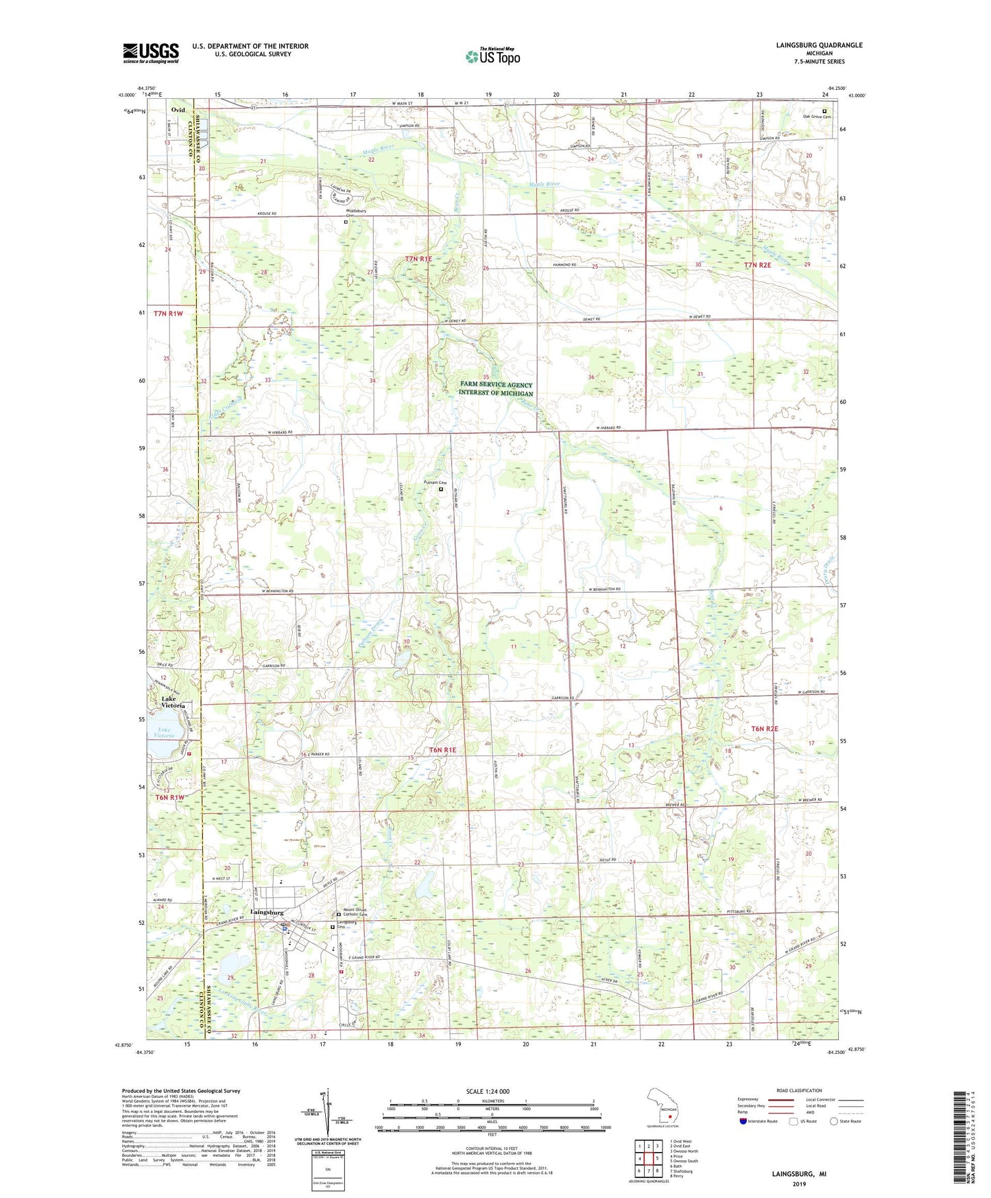
2023 topographic map quadrangle Laingsburg in the state of Michigan. Scale: 1:24000. Based on the newly updated USGS 7.5' US Topo map series, this map is in the following counties: Shiawassee, Clinton. The map contains contour data, water features, and other items you are used to seeing on USGS maps, but also has updated roads and other features. This is the next generation of topographic maps. Printed on high-quality waterproof paper with UV fade-resistant inks.
Quads adjacent to this one:
West: Price
Northwest: Ovid West
North: Ovid East
Northeast: Owosso North
East: Owosso South
Southeast: Perry
South: Shaftsburg
Southwest: Bath
This map covers the same area as the classic USGS quad with code o42084h3.
Contains the following named places: Alder Creek, Bates Scout Park, Bear Creek, Church of the Nazarene, City of Laingsburg, Clinton Area Fire and Rescue Station 4, Coon Creek, Diamond Lake, First Baptist Church, First Congregational Church, Laingsburg, Laingsburg Cemetery, Laingsburg Christian School, Laingsburg City Hall, Laingsburg City Library, Laingsburg City Police Dept, Laingsburg Elementary School, Laingsburg High School, Laingsburg Middle School, Laingsburg Post Office, Laingsburg Sciota Woodhull Emergency Services Fire station, Laingsburg Station, Laingsburg United Methodist Church, Lake Victoria, Lake Victoria Census Designated Place, Lee Field Airport, McClintock Park, Middlebury Cemetery, Middlebury Church, Mount Olivet Catholic Cemetery, Mulder Dairy Farm, Oak Grove Cemetery, Pine Hills Golf Course, Putnam Cemetery, Putnam Drain, Saint Isidore Catholic Church, Stork Drain, Township of Middlebury, Township of Sciota, Vermilion Creek, ZIP Code: 48848