MyTopo
Lake Arrowhead Michigan US Topo Map
Couldn't load pickup availability
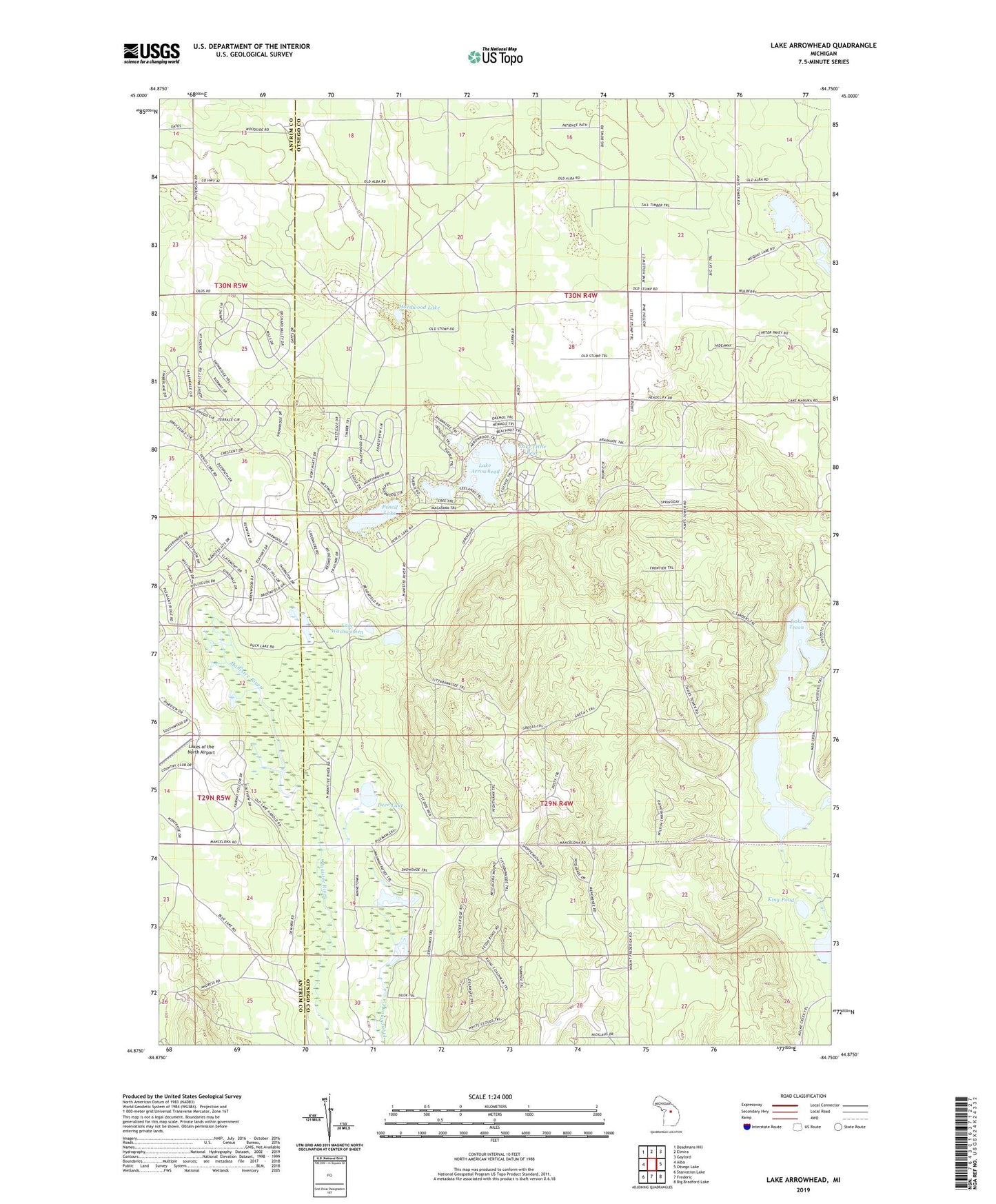
2019 topographic map quadrangle Lake Arrowhead in the state of Michigan. Scale: 1:24000. Based on the newly updated USGS 7.5' US Topo map series, this map is in the following counties: Otsego, Antrim. The map contains contour data, water features, and other items you are used to seeing on USGS maps, but also has updated roads and other features. This is the next generation of topographic maps. Printed on high-quality waterproof paper with UV fade-resistant inks.
Quads adjacent to this one:
West: Alba
Northwest: Deadmans Hill
North: Elmira
Northeast: Gaylord
East: Otsego Lake
Southeast: Big Bradford Lake
South: Frederic
Southwest: Starvation Lake
Contains the following named places: Buhl Lakes, Deer Lake, Freedom Covenant Fellowship Church, Hardwood Lake, Hayes Lookout Tower, King Pond, Lake Arrowhead, Lake Little Bear, Lake Tecon, Lake Washwomen, Lakes of the North Golf Course, Little Fawn Lake, Nisula Lake, Pencil Lake, Swan Lake, Thomas Lake, Township of Hayes