MyTopo
Big Bradford Lake Michigan US Topo Map
Couldn't load pickup availability
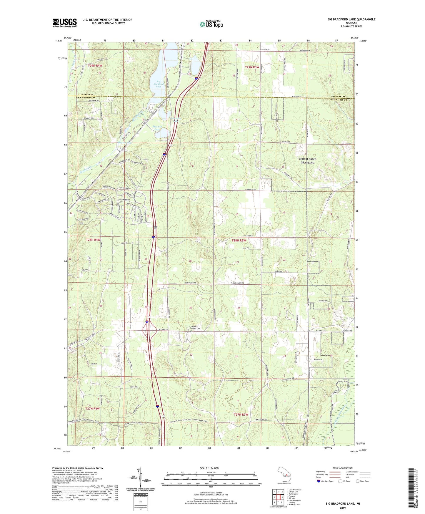
2023 topographic map quadrangle Big Bradford Lake in the state of Michigan. Scale: 1:24000. Based on the newly updated USGS 7.5' US Topo map series, this map is in the following counties: Crawford, Otsego. The map contains contour data, water features, and other items you are used to seeing on USGS maps, but also has updated roads and other features. This is the next generation of topographic maps. Printed on high-quality waterproof paper with UV fade-resistant inks.
Quads adjacent to this one:
West: Frederic
Northwest: Lake Arrowhead
North: Otsego Lake
Northeast: Turtle Lake
East: K P Lake
Southeast: Wakeley Lake
South: Grayling
Southwest: Lake Margrethe
This map covers the same area as the classic USGS quad with code o44084g6.
Contains the following named places: Bass Lake Cabins, Beaver Lake, Big Bradford Lake, Blue Gill Lake, Forbush Corner, Hartwick Pines Rest Area, Headwaters Camping and Cabins, Horseshoe Lake, Lake Marjory, Lake Marjory State Forest Campground, Maple Forest Cemetery, Maple Forest Township Hall, Township of Maple Forest, ZIP Code: 49733