MyTopo
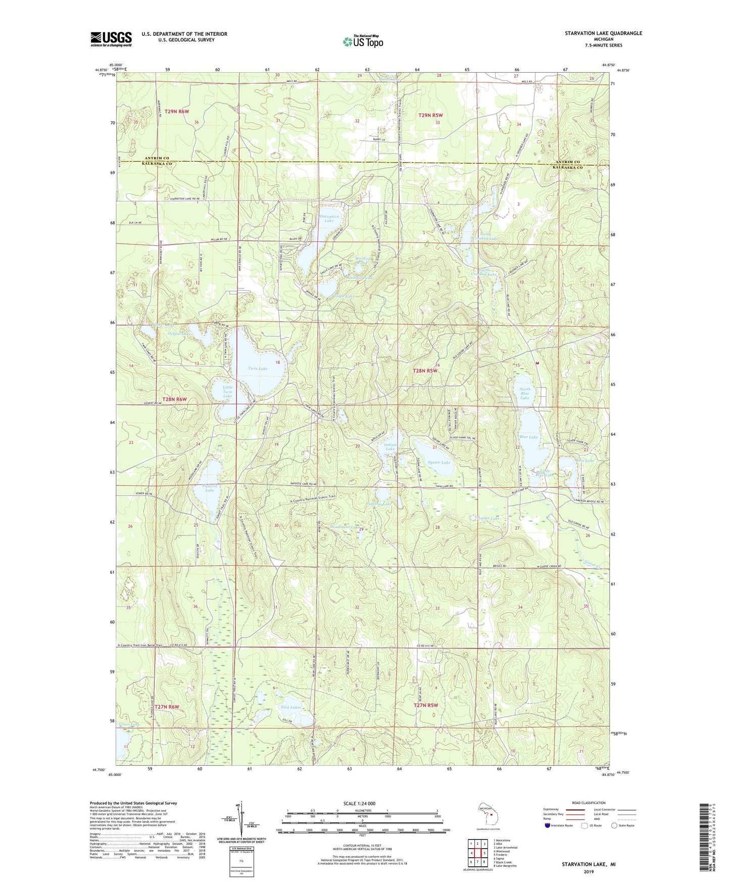
Starvation Lake Michigan US Topo Map
Couldn't load pickup availability
2023 topographic map quadrangle Starvation Lake in the state of Michigan. Scale: 1:24000. Based on the newly updated USGS 7.5' US Topo map series, this map is in the following counties: Kalkaska, Antrim. The map contains contour data, water features, and other items you are used to seeing on USGS maps, but also has updated roads and other features. This is the next generation of topographic maps. Printed on high-quality waterproof paper with UV fade-resistant inks.
Quads adjacent to this one:
West: Westwood
Northwest: Mancelona
North: Alba
Northeast: Lake Arrowhead
East: Frederic
Southeast: Lake Margrethe
South: Black Creek
Southwest: Sigma
This map covers the same area as the classic USGS quad with code o44084g8.
Contains the following named places: Barnhart School, Bass Lake, Blue Lake, Blue Lake Fire Hall, Blue Lake School, Blue Lake Township Fire Department, Blue Lake Township Hall, Camp Flying Eagle, Deadmans Lake, Eagle Lake, East Lakes, Indian Lake, Little Blue Lake, Little Twin Lake, MacNeil Pond, North Blue Lake, North Crooked Lake, Oxbow Lake, Papoose Lake, Pickerel Lake, Pickerel Lake (Kalkaska) State Forest Campground, Pickerel Lake Lookout Tower, Poplar Lake, South Crooked Lake, Squaw Lake, Starvation Lake, Timber Lake, Township of Blue Lake, Twin Lake, Waddell Pond