MyTopo
Lake Richie Michigan US Topo Map
Couldn't load pickup availability
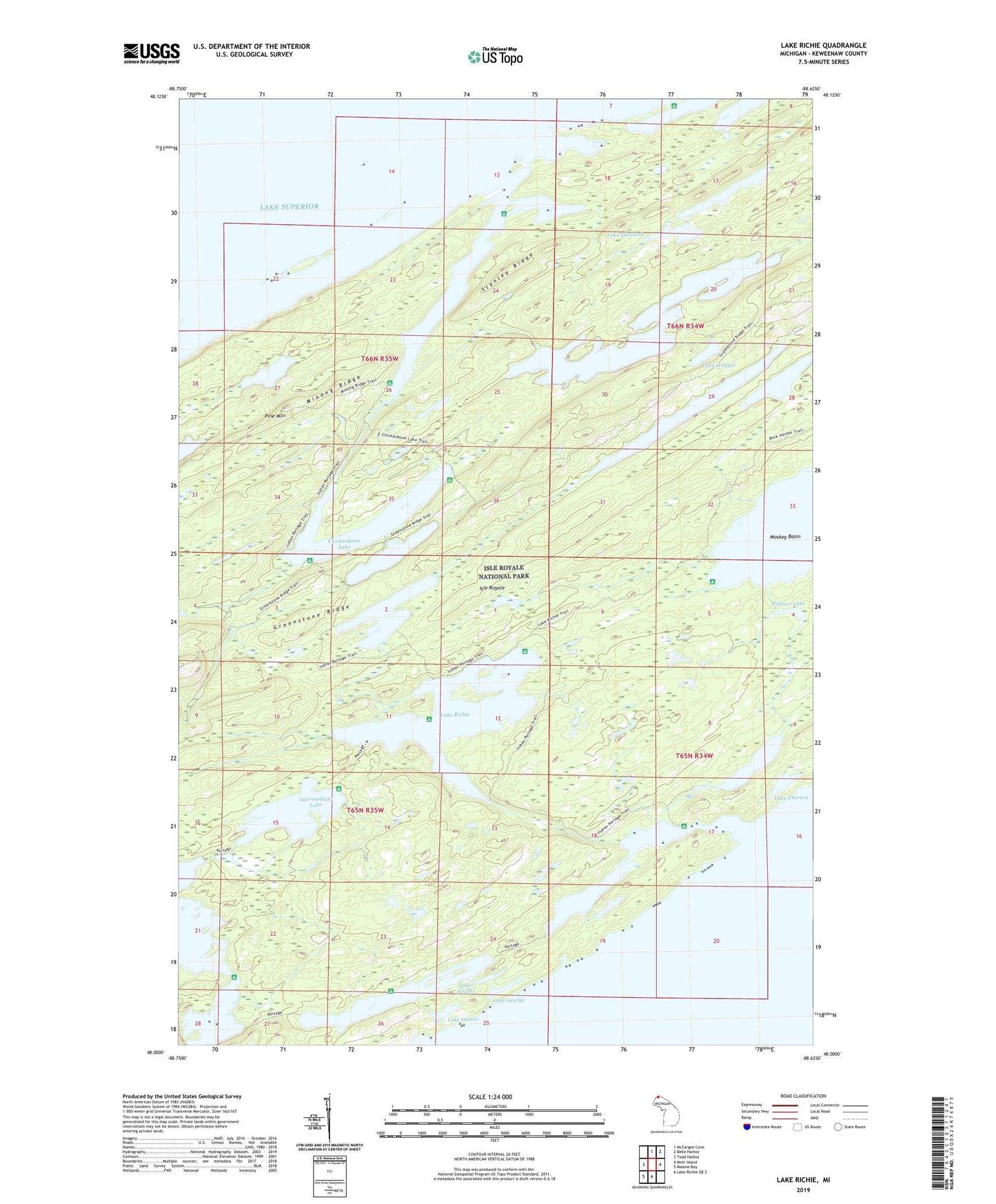
2019 topographic map quadrangle Lake Richie in the state of Michigan. Scale: 1:24000. Based on the newly updated USGS 7.5' US Topo map series, this map is in the following counties: Keweenaw. The map contains contour data, water features, and other items you are used to seeing on USGS maps, but also has updated roads and other features. This is the next generation of topographic maps. Printed on high-quality waterproof paper with UV fade-resistant inks.
Quads adjacent to this one:
West: Todd Harbor
North: McCargoe Cove
Northeast: Belle Harbor
East: Mott Island
South: Lake Richie OE S
Southwest: Malone Bay
Contains the following named places: Angleworm Lake, Birch Island, Birch Island Campground, Birch Isle, Blueberry Cove, Brady Cove, Chickenbone Lake, Chippewa Harbor, Chippewa Harbor Campground, East Chickenbone Lake Campground, Greenstone Beach, Hastings Island, Hawk Island, Indian Point, Indian Portage Trail, Intermediate Lake, Lake Benson, Lake Dustin, Lake Eva, Lake George, Lake Livermore, Lake Mason, Lake Richie, Lake Richie Campground, Lake Richie Trail, Lake Scholts, Lake Shesheeb, Lake Theresa, Lake Wagejo, Lake Whittlesey, LeSage Lake, Linklater Lake, McCargoe Cove, McCargoe Cove Campground, McDonald Lake, Minong Mine, Minong Post Office, Moskey Basin, Moskey Basin Campground, Ollies Dogs Rocks, Pine Mountain, Sargent Lake, Stanley Ridge, The Narrows, Wallace Lake, West Chickenbone Lake Campground, Wood Lake