MyTopo
Todd Harbor Michigan US Topo Map
Couldn't load pickup availability
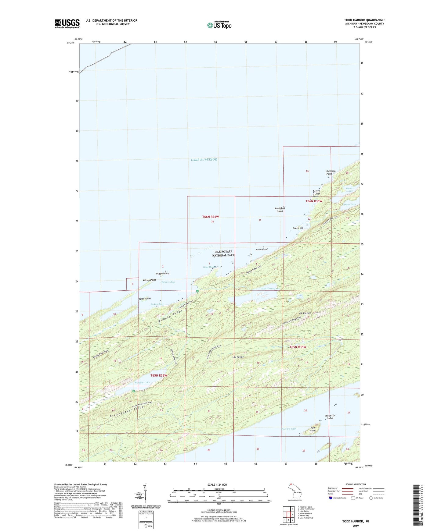
2023 topographic map quadrangle Todd Harbor in the state of Michigan. Scale: 1:24000. Based on the newly updated USGS 7.5' US Topo map series, this map is in the following counties: Keweenaw. The map contains contour data, water features, and other items you are used to seeing on USGS maps, but also has updated roads and other features. This is the next generation of topographic maps. Printed on high-quality waterproof paper with UV fade-resistant inks.
Quads adjacent to this one:
West: Little Todd Harbor
Northeast: McCargoe Cove
East: Lake Richie
Southeast: Lake Richie OE S
South: Malone Bay
Southwest: Point Houghton
This map covers the same area as the classic USGS quad with code o48088a7.
Contains the following named places: Arch Island, Beaver Lake, Florence Bay, Green Isle, Greenstone Ridge Trail, Hatchet Lake, Hatchet Lake Campground, Hatchett Lake Trail, Haytown Mine, Isle Royale National Park, Kamloops Island, Kamloops Point, Lake Harvey, Minong Ridge Fire Manway, Mount Siskiwit, Otter Lake, Pickett Bay, Ryan Island, Siskiwit Lake, Taylor Island, Teakettle Island, Todd Harbor, Todd Harbor Campground, Twelve O'Clock Point, Wilson Island, Wilson Point