MyTopo
Malone Bay Michigan US Topo Map
Couldn't load pickup availability
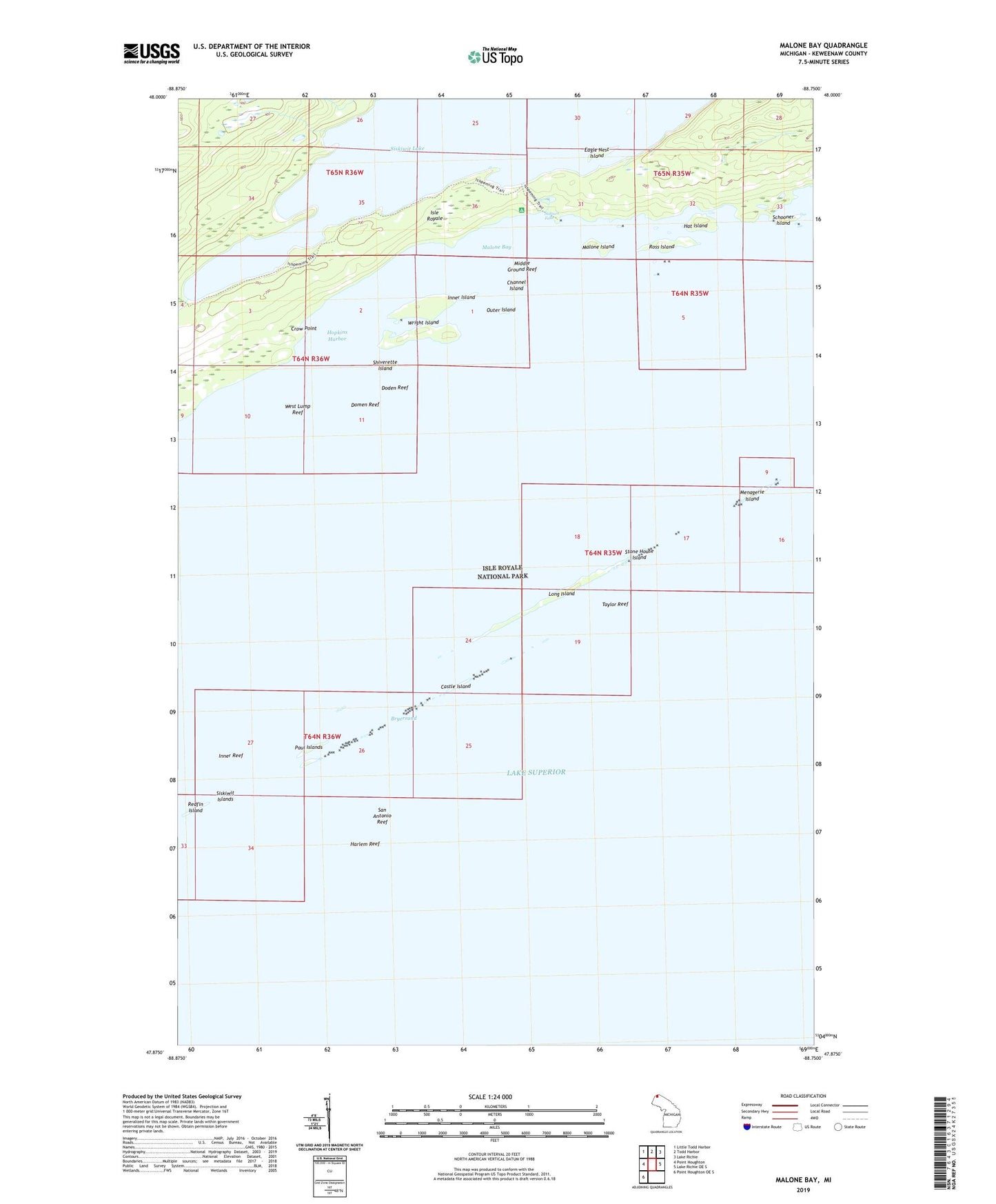
2023 topographic map quadrangle Malone Bay in the state of Michigan. Scale: 1:24000. Based on the newly updated USGS 7.5' US Topo map series, this map is in the following counties: Keweenaw. The map contains contour data, water features, and other items you are used to seeing on USGS maps, but also has updated roads and other features. This is the next generation of topographic maps. Printed on high-quality waterproof paper with UV fade-resistant inks.
Quads adjacent to this one:
West: Point Houghton
Northwest: Little Todd Harbor
North: Todd Harbor
Northeast: Lake Richie
East: Lake Richie OE S
Southwest: Point Houghton OE S
This map covers the same area as the classic USGS quad with code o47088h7.
Contains the following named places: Bryersund, Castle Island, Channel Island, Crow Point, Doden Reef, Dog Harbor, Domen Reef, Eagle Nest Island, Harlem Reef, Hat Island, Hopkins Harbor, Inner Island, Inner Reef, Ishpeming Trail, Isle Royale Lighthouse, Isle Royale Natinal Park Post Office, Long Island, Malone Bay, Malone Bay Campground, Malone Island, Menagerie Island, Middle Ground Reef, Outer Island, Paul Islands, Redfin Island, Ross Island, San Antonio Reef, Schooner Island, Shiverette Island, Siskiwit Falls, Siskiwit Islands, Siskiwit River, Stone House Island, Taylor Reef, West Lump Reef, Wright Island