MyTopo
Lakefield Michigan US Topo Map
Couldn't load pickup availability
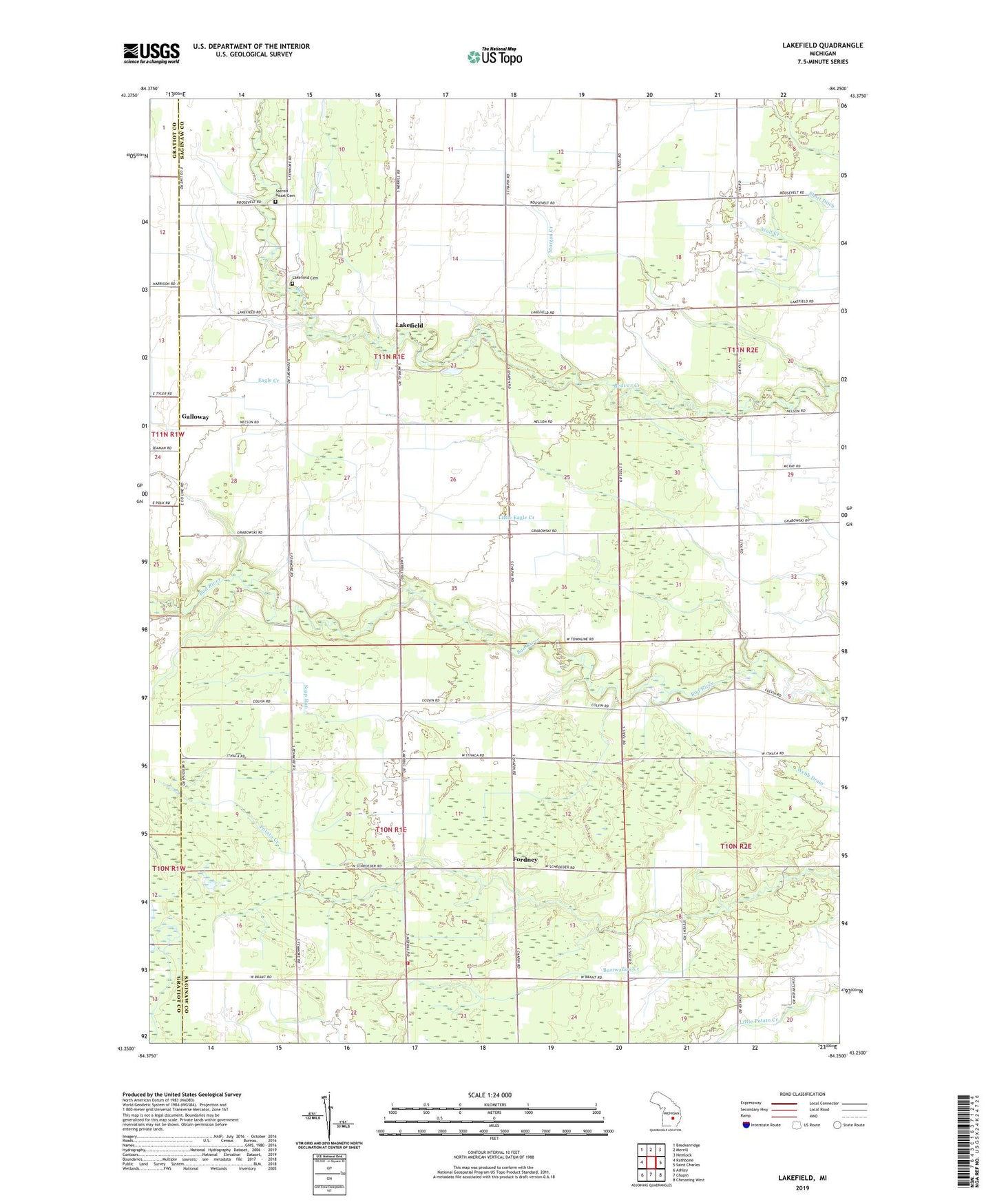
2019 topographic map quadrangle Lakefield in the state of Michigan. Scale: 1:24000. Based on the newly updated USGS 7.5' US Topo map series, this map is in the following counties: Saginaw, Gratiot. The map contains contour data, water features, and other items you are used to seeing on USGS maps, but also has updated roads and other features. This is the next generation of topographic maps. Printed on high-quality waterproof paper with UV fade-resistant inks.
Quads adjacent to this one:
West: Rathbone
Northwest: Breckenridge
North: Merrill
Northeast: Hemlock
East: Saint Charles
Southeast: Chesaning West
South: Chapin
Southwest: Ashley
Contains the following named places: Bearwallow Creek, Fordney, Fordney Post Office, Galloway, Galloway Post Office, Lakefield, Lakefield Cemetery, Lakefield Post Office, Little Eagle Creek, Marion Township Fire Department, Morgan Creek, Sacred Heart Cemetery, Soap Run, Township of Lakefield, Township of Marion, Twin Bridges Golf Course, ZIP Code: 48614