MyTopo
Rathbone Michigan US Topo Map
Couldn't load pickup availability
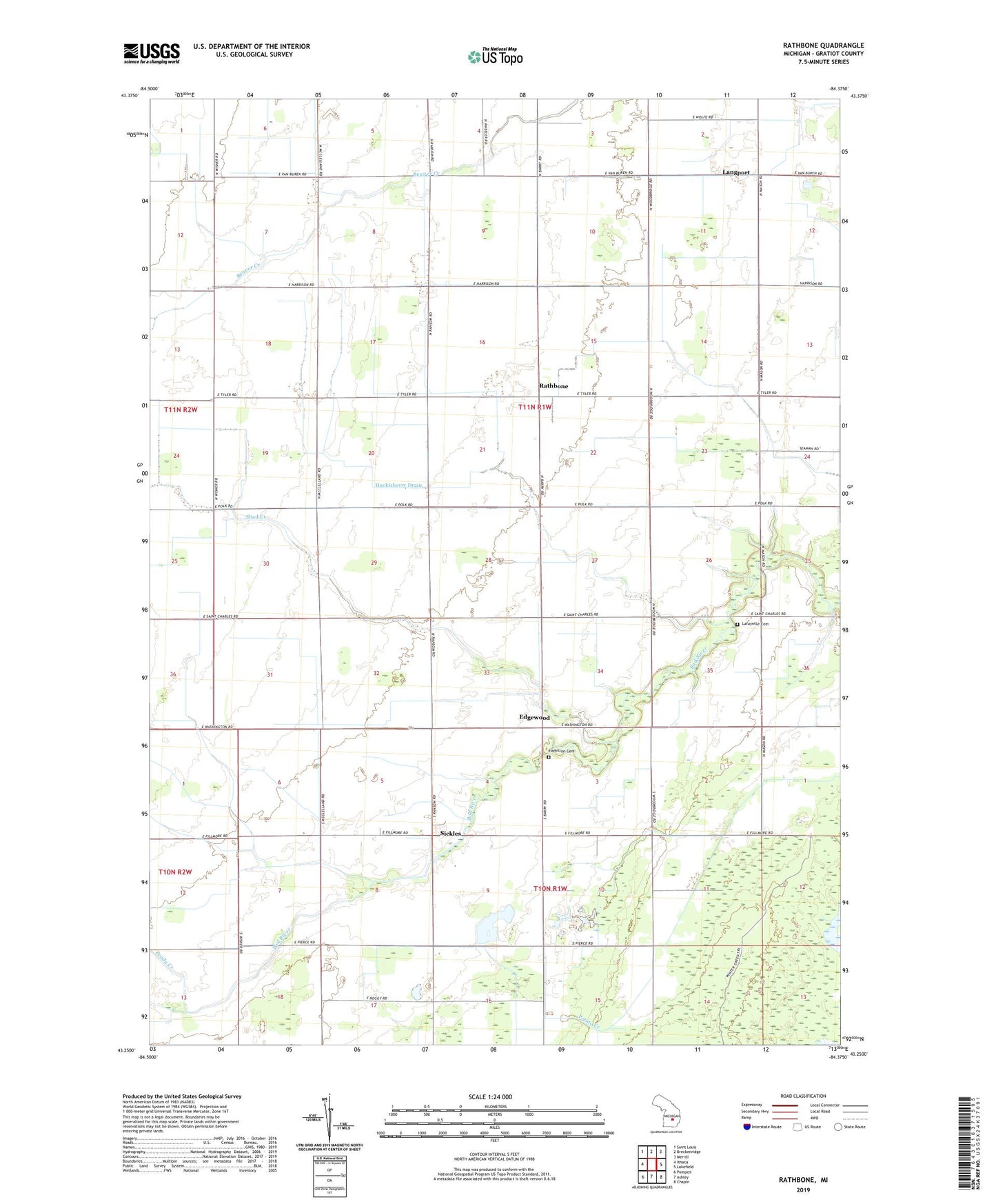
2023 topographic map quadrangle Rathbone in the state of Michigan. Scale: 1:24000. Based on the newly updated USGS 7.5' US Topo map series, this map is in the following counties: Gratiot. The map contains contour data, water features, and other items you are used to seeing on USGS maps, but also has updated roads and other features. This is the next generation of topographic maps. Printed on high-quality waterproof paper with UV fade-resistant inks.
Quads adjacent to this one:
West: Ithaca
Northwest: Saint Louis
North: Breckenridge
Northeast: Merrill
East: Lakefield
Southeast: Chapin
South: Ashley
Southwest: Pompeii
This map covers the same area as the classic USGS quad with code o43084c4.
Contains the following named places: Brady Creek, Edgewood, Edgewood Church of God, Edgewood Post Office, Emerson Church, Hamilton Cemetery, Huckleberry Drain, Just In Time Campground, Lafayette Cemetery, Lafayette Church, Lafeyette Post Office, Langport, Langport Post Office, Martin Drain, Rathbone, Rathbone Post Office, Shad Creek, Sickels Post Office, Sickles, Simmons Drain, Township of Lafayette