MyTopo
Larks Lake Michigan US Topo Map
Couldn't load pickup availability
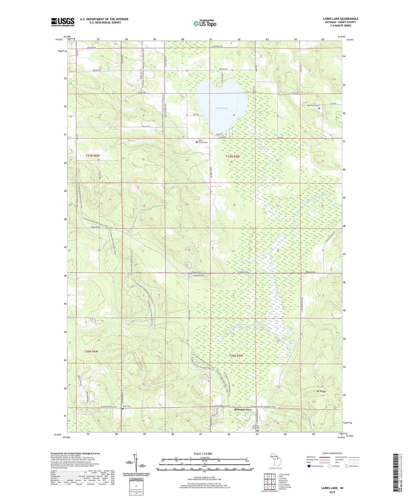
2023 topographic map quadrangle Larks Lake in the state of Michigan. Scale: 1:24000. Based on the newly updated USGS 7.5' US Topo map series, this map is in the following counties: Emmet. The map contains contour data, water features, and other items you are used to seeing on USGS maps, but also has updated roads and other features. This is the next generation of topographic maps. Printed on high-quality waterproof paper with UV fade-resistant inks.
Quads adjacent to this one:
West: Good Hart
Northwest: Cross Village
North: Bliss
Northeast: Levering
East: Pellston
Southeast: Alanson
South: Harbor Springs
Southwest: Forest Beach
This map covers the same area as the classic USGS quad with code o45084e8.
Contains the following named places: Brush Creek, Camp Pellston, Emmet County, Four Lakes, Greenwood Cemetery, Larks Lake, Larks Lake Swamp, Larks Post Office, Maple Tree Corners, Marsh Corner, Mount Pisage, Pioneer Park, Pioneer Picnic Park Historical Marker, Pleasant View, Pleasant View Cemetery, Pleasant View Swamp, Pleasantview Post Office, Saint Nichols Cemetery, Saint Nichols Church, Starr Cemetery, Township of Center, Township of Pleasantview, True North Golf Club