MyTopo
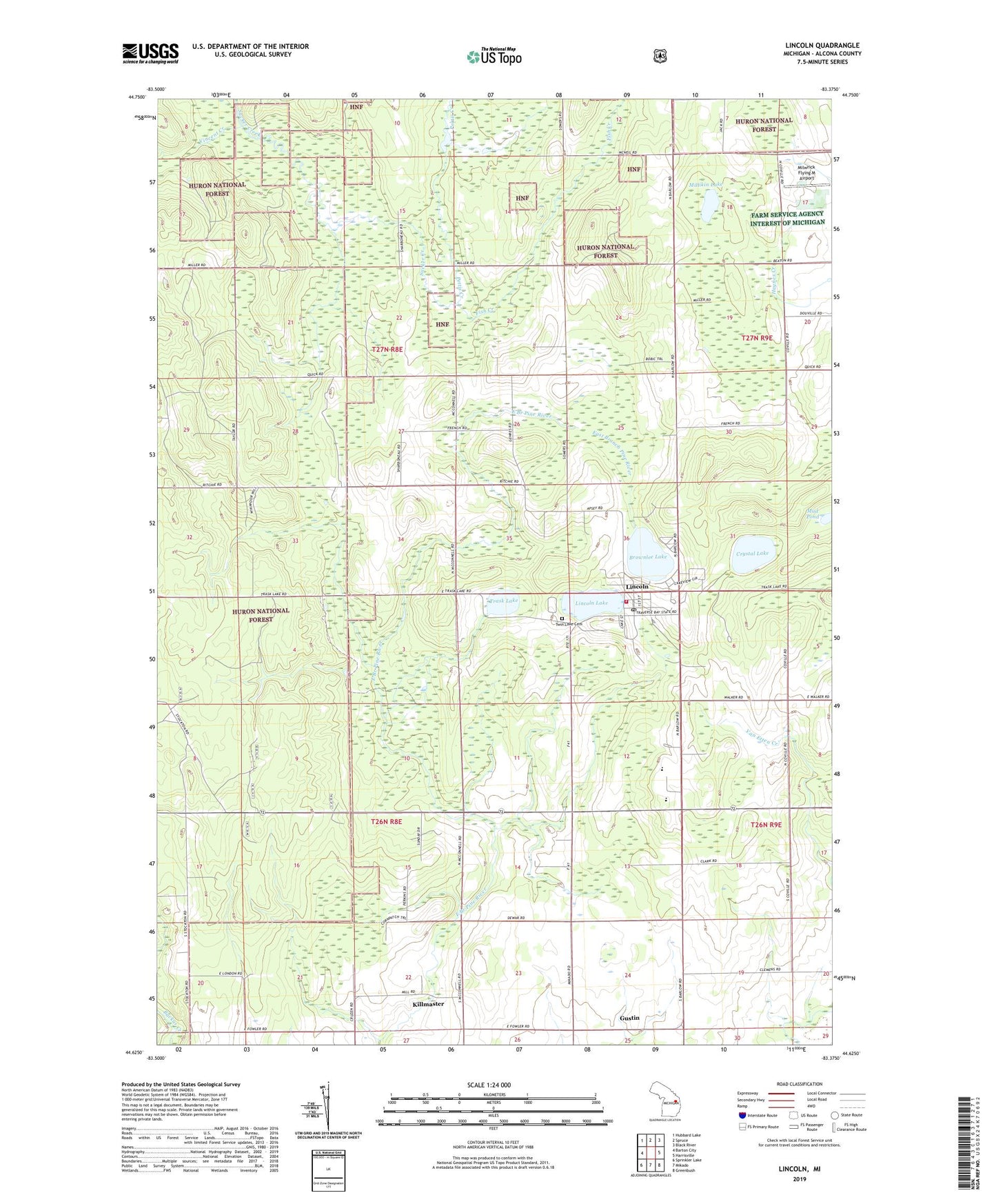
Lincoln Michigan US Topo Map
Couldn't load pickup availability
Also explore the Lincoln Forest Service Topo of this same quad for updated USFS data
2023 topographic map quadrangle Lincoln in the state of Michigan. Scale: 1:24000. Based on the newly updated USGS 7.5' US Topo map series, this map is in the following counties: Alcona. The map contains contour data, water features, and other items you are used to seeing on USGS maps, but also has updated roads and other features. This is the next generation of topographic maps. Printed on high-quality waterproof paper with UV fade-resistant inks.
Quads adjacent to this one:
West: Barton City
Northwest: Hubbard Lake
North: Spruce
Northeast: Black River
East: Harrisville
Southeast: Greenbush
South: Mikado
Southwest: Sprinkler Lake
This map covers the same area as the classic USGS quad with code o44083f4.
Contains the following named places: Alcona County Emergency Medical Services Station 1, Alcona County Fairgrounds, Alcona County Recreation Area, Alcona Elementary School, Alcona Health Center, Alcona High School, Brownlee Lake, Church of God, Crystal Lake, Faith Lutheran Church, First Baptist Church, Fish Creek, Gustin, Gustin Post Office, Gustin Station, Gustin Township Hall, Hawes Post Office, Killmaster, Killmaster Post Office, Lincoln, Lincoln Branch Library, Lincoln Haven Health Care Center, Lincoln Lake, Lincoln Lookout Tower, Lincoln Post Office, Lincoln Station, Lincoln Volunteer Fire Department, Millikin Lake, Milwrick Flying M Airport, Mud Pond, Pettis Creek, Township of Gustin, Trask Lake, Trinity Evangelical Lutheran Church, Twin Lake Cemetery, United Methodist Church, Village of Lincoln, Vincent Creek, West Harrisville Depot Historical Marker, ZIP Code: 48742