MyTopo
Loomis Michigan US Topo Map
Couldn't load pickup availability
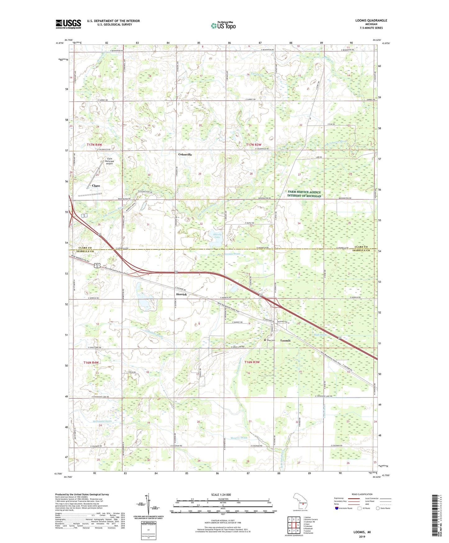
2023 topographic map quadrangle Loomis in the state of Michigan. Scale: 1:24000. Based on the newly updated USGS 7.5' US Topo map series, this map is in the following counties: Isabella, Clare. The map contains contour data, water features, and other items you are used to seeing on USGS maps, but also has updated roads and other features. This is the next generation of topographic maps. Printed on high-quality waterproof paper with UV fade-resistant inks.
Quads adjacent to this one:
West: Clare
Northwest: Hatton
North: Browns Corners
Northeast: Coleman NE
East: Coleman
Southeast: Alamando
South: Leaton
Southwest: Rosebush
This map covers the same area as the classic USGS quad with code o43084g6.
Contains the following named places: Carrow Creek, Clare Municipal Airport, Clare Welcome Center, Colonville, Colonville Bible Church, Colonville Post Office, Curtis Drain, Elm Grove Cemetery, Grace Bible Church, Herrick, Herrick Post Office, Herrick Recreation Area, Herrick Station, Lamphere Drain, Loomis, Loomis Census Designated Place, Loomis Drain, Loomis Post Office, Loomis Station, McCuran Creek, McDonald Drain, Menery Drain, Michigan's Petroleum Industry Historical Marker, New Hope Fellowship Missionary Church, Salem Church, Sanford Creek, Sheridan Township Hall, Shively Lake, Township of Sheridan, Township of Wise, Wise Cemetery, Wise Oil Field, ZIP Code: 48617