MyTopo
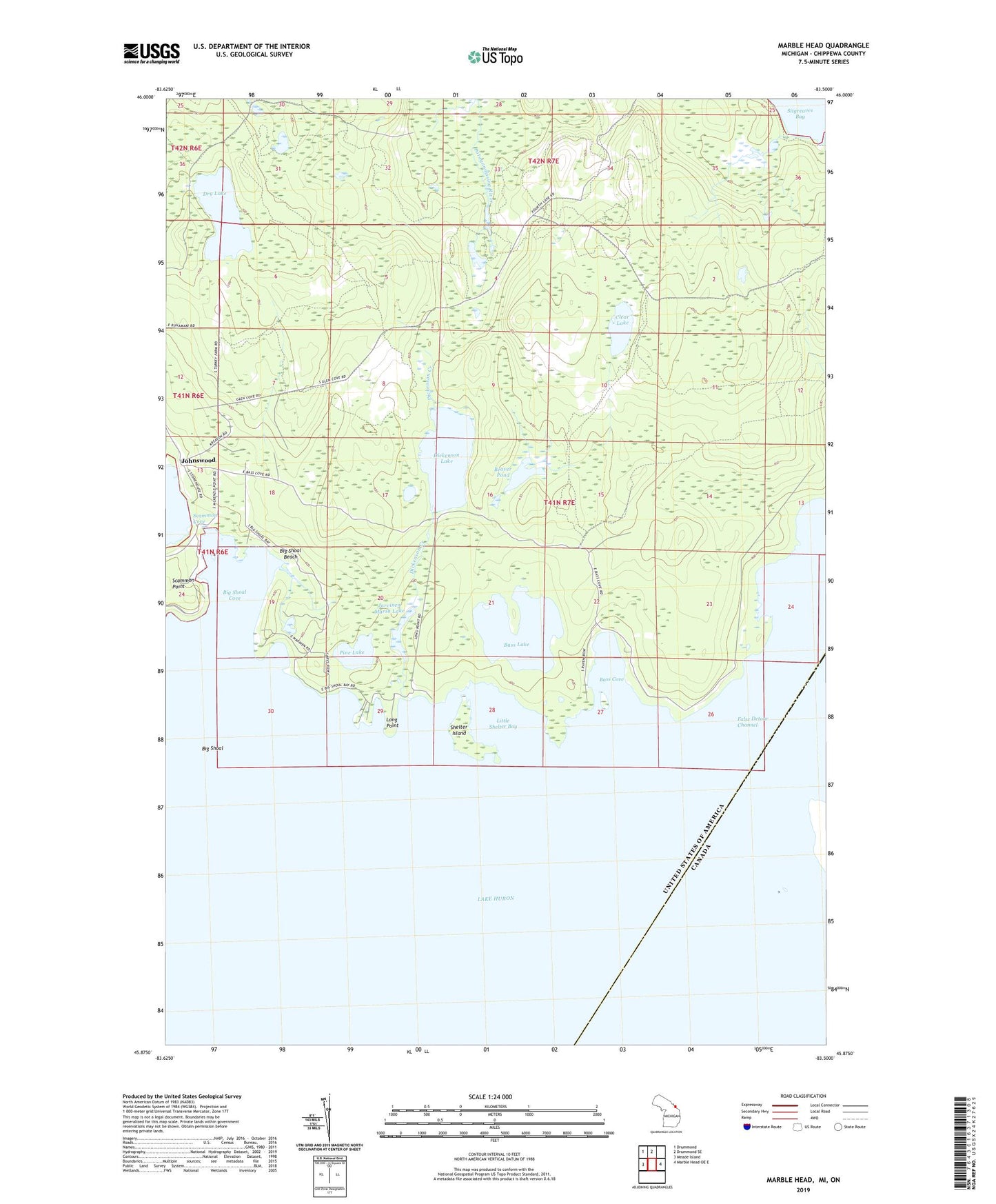
Marble Head Michigan US Topo Map
Couldn't load pickup availability
2023 topographic map quadrangle Marble Head in the state of Michigan. Scale: 1:24000. Based on the newly updated USGS 7.5' US Topo map series, this map is in the following counties: Chippewa. The map contains contour data, water features, and other items you are used to seeing on USGS maps, but also has updated roads and other features. This is the next generation of topographic maps. Printed on high-quality waterproof paper with UV fade-resistant inks.
Quads adjacent to this one:
West: Meade Island
Northwest: Drummond
North: Drummond SE
East: Marble Head OE E
This map covers the same area as the classic USGS quad with code o45083h5.
Contains the following named places: Bass Cove, Bass Lake, Beaver Pond, Big Shoal, Big Shoal Beach, Big Shoal Cove, Clear Lake, Dickenson Creek, Dickenson Lake, Dry Lake, Jarvinen Marsh Lake, Johns Wood Post Office, Johnswood, Little Shelter Bay, Long Point, Pine Lake, Scammon Post Office, Shelter Island, Sitgreaves Bay