MyTopo
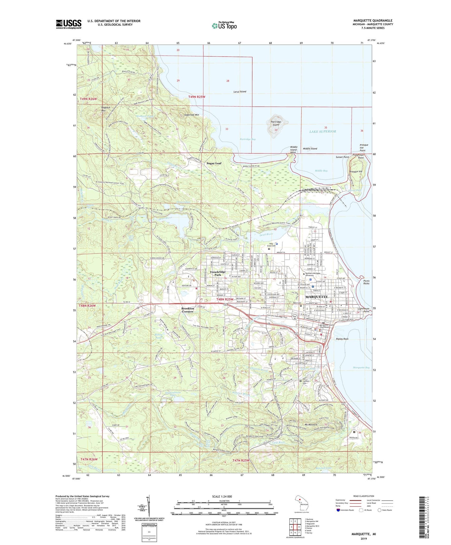
Marquette Michigan US Topo Map
Couldn't load pickup availability
2023 topographic map quadrangle Marquette in the state of Michigan. Scale: 1:24000. Based on the newly updated USGS 7.5' US Topo map series, this map is in the following counties: Marquette. The map contains contour data, water features, and other items you are used to seeing on USGS maps, but also has updated roads and other features. This is the next generation of topographic maps. Printed on high-quality waterproof paper with UV fade-resistant inks.
Quads adjacent to this one:
West: Negaunee
Northwest: Buckroe
North: Marquette NW
East: Marquette OE E
Southeast: Harvey
South: Sands
Southwest: Palmer
This map covers the same area as the classic USGS quad with code o46087e4.
Contains the following named places: Art and Design North, Baraga School, Berry Events Center, Bethel Baptist Church, Bishop Pond, Bothwell Middle School, Bottum University Center, Brookton Corners, Buschell Lake, C B Hedgcock Student Service Center, Calvary Lutheran Church, Campbell Supply Company, Carey Hall, Carp River, Center/Norwood/Lincoln Apartments, City of Marquette, Coast Guard Station Marquette, Cohodas Administrative Center, Compeau Creek, Contract Oil Company, Dead River, Dead River Falls, Digestive Health Clinic, Ellwood A Mattson Lower Harbor Park, Enchantment Lake, Eye Associates of Marquette, Faith Evangelical Lutheran Church, Faith in Christ Fellowship, Father Marquette Catholic Academy, Father Marquette Middle School, Father Marquette Park, First Baptist Church, First Presbyterian Church, First Steam Railroad in Upper Peninsula Historical Marker, First United Methodist Church, Fisherman Point, Forest Roberts Theatre, Forestville, Freeman Landing, Froebel Howard School, Gant Hall, Giants Foot Park, Grace Community Church of the Nazarene, Grace United Methodist Church, Graveraet Elementary School, Great Lakes Podiatry Clinic, Greek Orthodox Church of the Assumption, Grey Walls Golf Course, Gries Hall, Halverson Hall, Harbor Basin, Harden Learning Resources Center, Harlow Park, His House Christian Fellowship, Hogback Mountain, Holeyoke Falls, Holy Cross Cemetery, Holyoke Creek, Hunt Hall, Jacobetti Center, Jacobetti Storage Building, Jacques Marquette Historical Marker, Jamrich Hall, Kaye House, Lake Superior Yacht Yard, Lakeside Park, Larus Island, Lee Hall, Lighthouse Point, Lions Park, Lower Carp River Falls, Lower Harbor Breakwall Lighthouse, Lydia M Olson Library, Magers Hall, Marquette, Marquette Alternative High School, Marquette Bay, Marquette Bible Church, Marquette Branch Prison, Marquette City Fire Department Station 1, Marquette City Fire Department Station 2, Marquette City Hall, Marquette County Courthouse, Marquette County Courthouse Historical Marker, Marquette County History Museum, Marquette County Sheriff's Office, Marquette Dock Association, Marquette Dock Company Coal Dock, Marquette Ear Nose and Throat Clinic, Marquette General Hospital, Marquette Golf and Country Club, Marquette Gospel Tabernacle Church, Marquette Internal Medicine Clinic, Marquette Lakeview Arena, Marquette Lighthouse, Marquette Marine Incorportated, Marquette Maritime Museum, Marquette Missionary Church, Marquette Mountain Ski Area, Marquette Police Department, Marquette Post Office, Marquette Station, Marquette Township Fire and Rescue, McCarty Cave Park, McClintock Building, Mediride Emergency Medical Services, Messiah Lutheran Church, Meyland Hall, Michigan State Police District 8 Headquarters, Middle Bay, Middle Island, Middle Island Point, Midway Creek, Morgan Creek, Morgan Falls, Mount Mesnard, Murphy Oil Corporation, Nestor School, New Life Church, New Science Facility, North Marquette Outdoor Recreation Area, Northern Michigan University, Northern Michigan University Historical Marker, Northern Michigan University Police Department, Northshore Christian Church, Old Catholic Cemetery, Orianna Brook, Park Cemetery, Partridge Bay, Partridge Island, Payne Hall, Peter White Public Library, Physical Education Instructional Facility, Picnic Rocks, Picnic Rocks Park, Pioneer Estates, Pocket Park, Presque Isle, Presque Isle Harbor, Presque Isle Marina, Presque Isle Park, Presque Isle Point, Presque Isle Station Upper Peninsula Generating Company, Quad I Food Service Building, Quad II Central Area, Quarry Pond, Reany Creek, Reany Falls, Redeemer Lutheran Church, Ripley Heating Plant, Ripley Rock, River Park, Roland Palmede National Ski Library, Saint Christopher Parish, Saint Mark's Lutheran Church, Saint Michael Catholic Church, Saint Paul's Episcopal Church, Saint Peters Cathedral, Sandy Knoll Elementary School, Services Building, Setter Field, Shiras Generating Plant, Shiras Hill Park, Shiras Park, Shiras Pool, South Beach Park, Spalding Hall, Spooner Hall, Spring Street Park, Sugar Loaf, Sugarloaf Mountain, Summit/Center Apartments, Sunset Point, Superior Dome, Superior Hills Elementary School, Thomas Fine Arts Building, Three Lakes, Tourist Park, Trowbridge Park, Trowbridge Park Census Designated Place, United States National Ski Hall of Fame, Unity Church of Inner Peace, Upper Peninsula Children's Museum, Upper Peninsula Medical Center, Van Antwerp Hall, Veteran's Association Hospital, Vielmetti Health Center, WDMJ Radio Tower (Menominee), WDMJ-AM (Marquette), West Hall, West Science Building, Westren Brook, Westwood Mall, Wetmore Landing, Wetmore Pond, WFXD-FM (Marquette), Whetstone Brook, Whitman School, Williams Park, WJPD-FM (Ishpeming), ZIP Code: 49855


