MyTopo
Sands Michigan US Topo Map
Couldn't load pickup availability
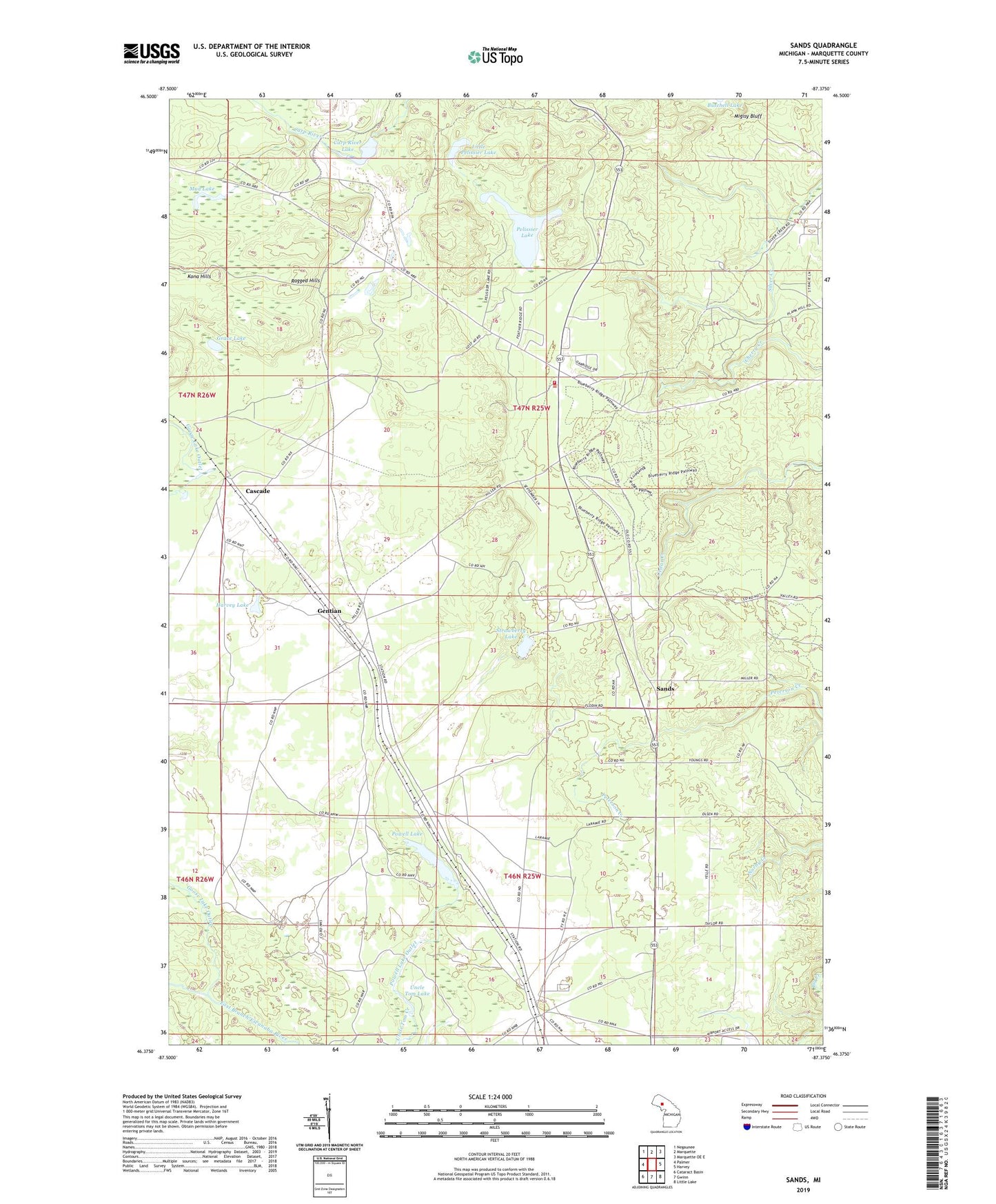
2023 topographic map quadrangle Sands in the state of Michigan. Scale: 1:24000. Based on the newly updated USGS 7.5' US Topo map series, this map is in the following counties: Marquette. The map contains contour data, water features, and other items you are used to seeing on USGS maps, but also has updated roads and other features. This is the next generation of topographic maps. Printed on high-quality waterproof paper with UV fade-resistant inks.
Quads adjacent to this one:
West: Palmer
Northwest: Negaunee
North: Marquette
Northeast: Marquette OE E
East: Harvey
Southeast: Little Lake
South: Gwinn
Southwest: Cataract Basin
This map covers the same area as the classic USGS quad with code o46087d4.
Contains the following named places: Carp River Lake, Cascade, Gentian, Goose Lake Outlet, Grace Korean Church, Grace Lake, Harvey Lake, Lake Superior Christian Church, Little Pelissier Lake, Marquette County Fairgrounds, Migisy Bluff, Mud Lake, Pelissier Lake, Powell Lake, Powell Lake Outlet, Ragged Hills, Sands, Sands Post Office, Sands Station, Sands Township Fire Department, Sands Trailer Court, Shiloh Baptist Church, Strawberry Lake, Township of Sands, Uncle Tom Lake, WHWL-FM (Marquette)