MyTopo
McNearney Lake Michigan US Topo Map
Couldn't load pickup availability
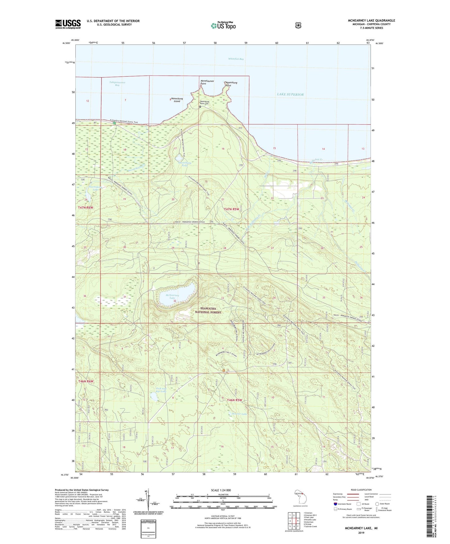
2019 topographic map quadrangle McNearney Lake in the state of Michigan. Scale: 1:24000. Based on the newly updated USGS 7.5' US Topo map series, this map is in the following counties: Chippewa. The map contains contour data, water features, and other items you are used to seeing on USGS maps, but also has updated roads and other features. This is the next generation of topographic maps. Printed on high-quality waterproof paper with UV fade-resistant inks.
Quads adjacent to this one:
West: Piatt Lake
Northwest: Emerson
North: Emerson OE E
East: Pendills Lake
Southeast: Sullivan Creek
South: Strongs
Southwest: Eckerman
Contains the following named places: Ankodosh Creek, Bergman Creek, Halfaday Creek, McNearney Lake, McNearney Lake Tower, Menekaunee Point, Mill Creek, Naomikong Creek, Naomikong Island, Naomikong Lake, Naomikong Point, Naomikong Point Cemetery, Naomikong Pond, Peck and Rye Lake, Proctor Lake, West Branch Halfaday Creek, WSUE-FM (Sault Sainte Marie)