MyTopo
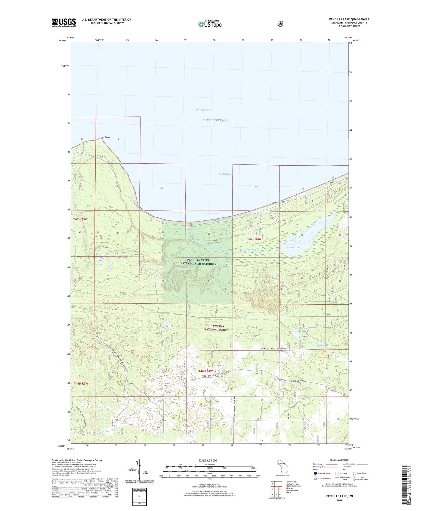
Pendills Lake Michigan US Topo Map
Couldn't load pickup availability
Also explore the Pendills Lake Forest Service Topo of this same quad for updated USFS data
2023 topographic map quadrangle Pendills Lake in the state of Michigan. Scale: 1:24000. Based on the newly updated USGS 7.5' US Topo map series, this map is in the following counties: Chippewa. The map contains contour data, water features, and other items you are used to seeing on USGS maps, but also has updated roads and other features. This is the next generation of topographic maps. Printed on high-quality waterproof paper with UV fade-resistant inks.
Quads adjacent to this one:
West: McNearney Lake
Northwest: Emerson OE E
East: Dollar Settlement
Southeast: Raco
South: Sullivan Creek
Southwest: Strongs
This map covers the same area as the classic USGS quad with code o46084d7.
Contains the following named places: Avery Lake, Bayou Pond, Bayview Camp Grounds, Big Pines Picnic Area, Grant Creek, Ladd Creek, Little Avery Lake, Pendills Bay, Pendills Creek, Pendills Creek National Fish Hatchery, Pendills Lake, Salt Point, Township of Bay Mills, Viddian Creek, Whitefish Bay