MyTopo
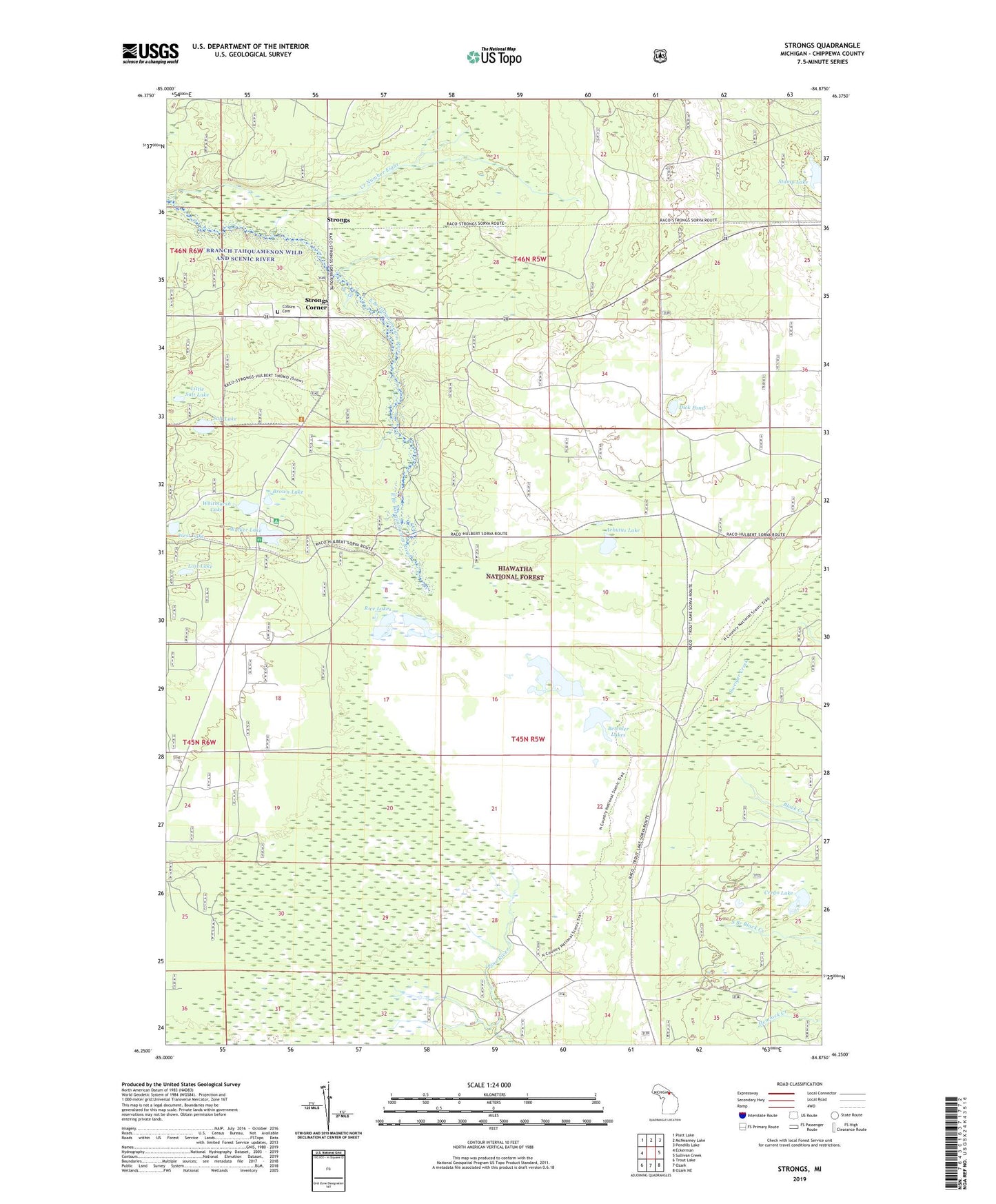
Strongs Michigan US Topo Map
Couldn't load pickup availability
Also explore the Strongs Forest Service Topo of this same quad for updated USFS data
2023 topographic map quadrangle Strongs in the state of Michigan. Scale: 1:24000. Based on the newly updated USGS 7.5' US Topo map series, this map is in the following counties: Chippewa. The map contains contour data, water features, and other items you are used to seeing on USGS maps, but also has updated roads and other features. This is the next generation of topographic maps. Printed on high-quality waterproof paper with UV fade-resistant inks.
Quads adjacent to this one:
West: Eckerman
Northwest: Piatt Lake
North: McNearney Lake
Northeast: Pendills Lake
East: Sullivan Creek
Southeast: Ozark NE
South: Ozark
Southwest: Trout Lake
This map covers the same area as the classic USGS quad with code o46084c8.
Contains the following named places: Arbutus Lake, Betchler Lakes, Brown Lake, Chippewa County Ambulance Service, Coburn Cemetery, Community Church, Creek Number Eight, Crego Lake, Dick Pond, Jones School, Little Salt Lake, Lost Lake, Rice Lakes, Salt Lake, Strongs, Strongs Corner, Strongs Post Office, Strongs Station, Stump Lake, Three Lakes Campground, Walker Lake, West Lake, Whitmarsh Lake