MyTopo
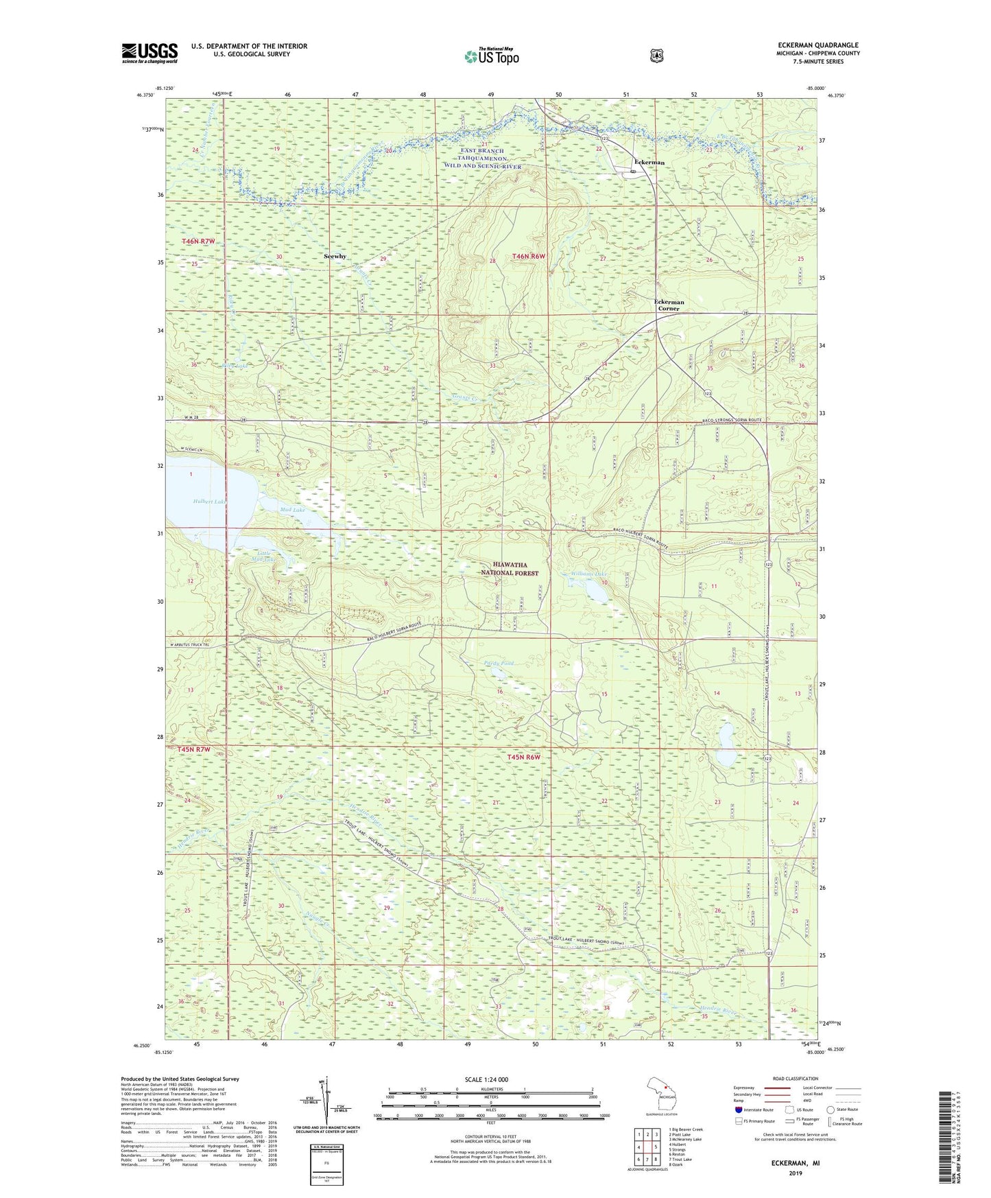
Eckerman Michigan US Topo Map
Couldn't load pickup availability
Also explore the Eckerman Forest Service Topo of this same quad for updated USFS data
2023 topographic map quadrangle Eckerman in the state of Michigan. Scale: 1:24000. Based on the newly updated USGS 7.5' US Topo map series, this map is in the following counties: Chippewa. The map contains contour data, water features, and other items you are used to seeing on USGS maps, but also has updated roads and other features. This is the next generation of topographic maps. Printed on high-quality waterproof paper with UV fade-resistant inks.
Quads adjacent to this one:
West: Hulbert
Northwest: Big Beaver Creek
North: Piatt Lake
Northeast: McNearney Lake
East: Strongs
Southeast: Ozark
South: Trout Lake
Southwest: Rexton
This map covers the same area as the classic USGS quad with code o46085c1.
Contains the following named places: Creek Number Fourteen, Deerfoot Lake, East Branch Tahquamenon Wild and Scenic River, Eckerman, Eckerman Corner, Eckerman Corner Lookout Tower, Eckerman Post Office, Eckerman Station, Grants Creek, Hendrie River Camp, Howard City Club, Hulbert Lake, LaRock Cabins, Little Mud Lake, Mud Lake, Naugle Creek, No Doe Hunting Club, O Conner Airstrip, Pardy Pond, Petersburg Club, Riley Lake, Seewhy, Seewhy Post Office, Seewhy Station, Township of Chippewa, Williams Lake