MyTopo
Mendon Michigan US Topo Map
Couldn't load pickup availability
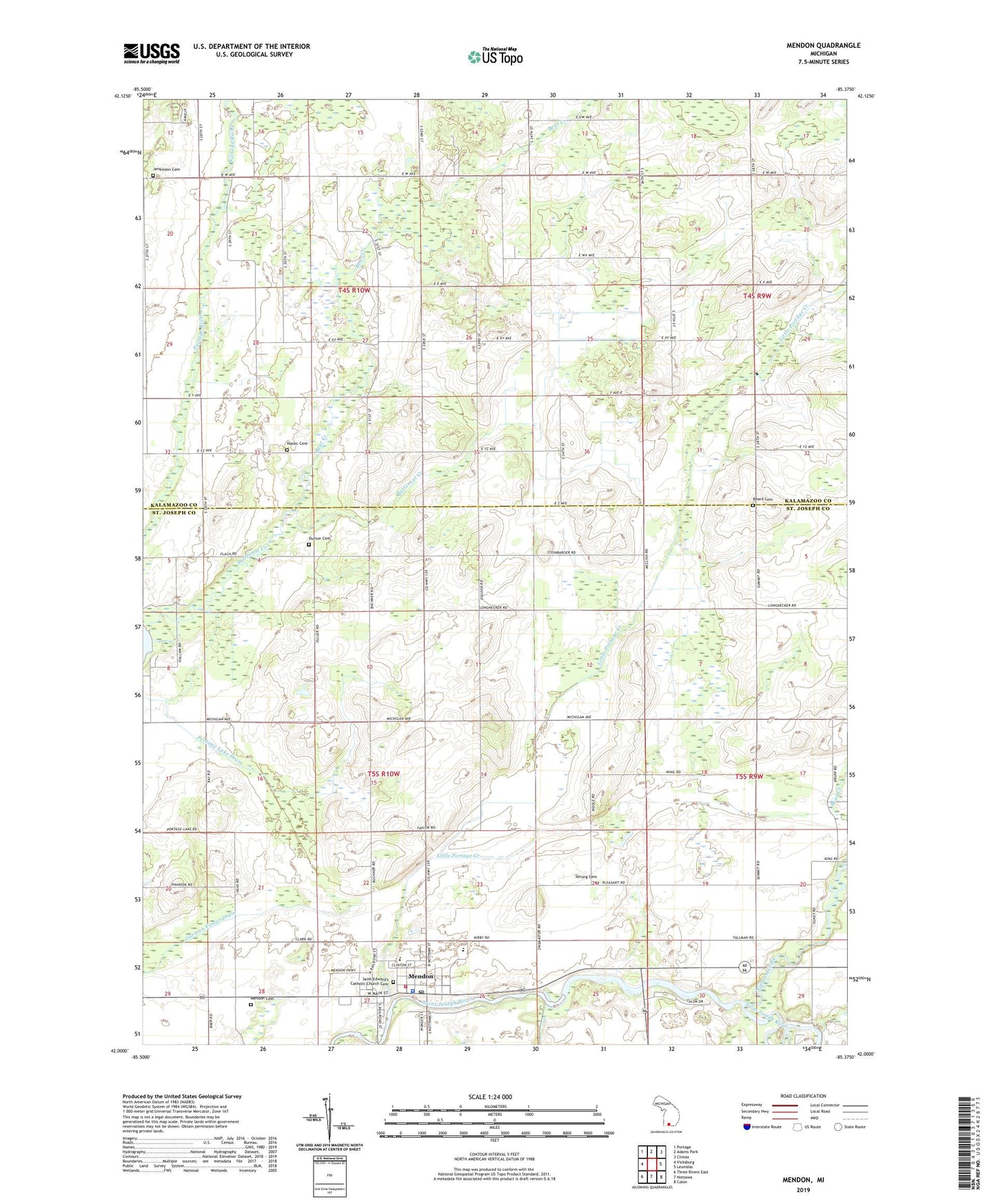
2019 topographic map quadrangle Mendon in the state of Michigan. Scale: 1:24000. Based on the newly updated USGS 7.5' US Topo map series, this map is in the following counties: St. Joseph, Kalamazoo. The map contains contour data, water features, and other items you are used to seeing on USGS maps, but also has updated roads and other features. This is the next generation of topographic maps. Printed on high-quality waterproof paper with UV fade-resistant inks.
Quads adjacent to this one:
West: Vicksburg
Northwest: Portage
North: Adams Park
Northeast: Climax
East: Leonidas
Southeast: Colon
South: Nottawa
Southwest: Three Rivers East
Contains the following named places: Bear Creek, Beard Cemetery, Brady School, Brown School, Butternut Creek, Dinger School, Dutton Cemetery, Freedom Baptist Church, Garman Foster Drain, Hall School, Hassic Cemetery, Holcomb School, Jenkinson Cemetery, Jenkinson School, Kings Mill, Life Care Ambulance Service, Little Portage Creek, Maple Grove School, Mendon, Mendon Cemetery, Mendon Community High School, Mendon Elementary School, Mendon Fire Department, Mendon Police Department, Mendon Post Office, Mendon Station, Mendon Township Hall, Mendon Township Library, Mendon United Methodist Church, Nottawa Creek, Oak Shores Resort Campground, Olney Bridge Park, Portage Lake Drain, Rawson's King Mill Park, Reserve School, Saint Edwards Catholic Church, Saint Edward's Catholic Church Cemetery, Saint Patrick Parish, Sprung Cemetery, Township of Brady, Township of Mendon, Village of Mendon, Wakeshma Church, ZIP Codes: 49072, 49097