MyTopo
Nottawa Michigan US Topo Map
Couldn't load pickup availability
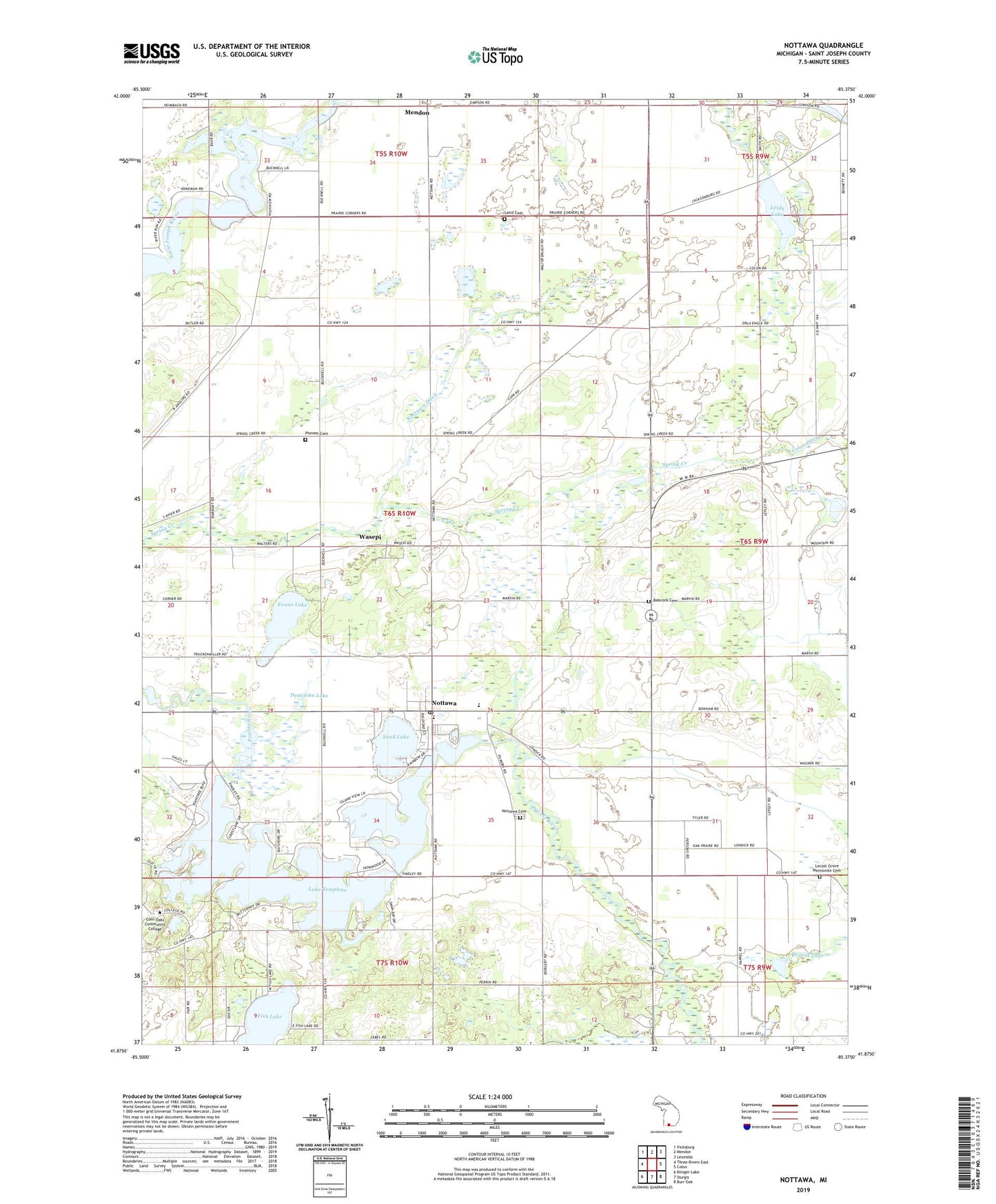
2023 topographic map quadrangle Nottawa in the state of Michigan. Scale: 1:24000. Based on the newly updated USGS 7.5' US Topo map series, this map is in the following counties: St. Joseph. The map contains contour data, water features, and other items you are used to seeing on USGS maps, but also has updated roads and other features. This is the next generation of topographic maps. Printed on high-quality waterproof paper with UV fade-resistant inks.
Quads adjacent to this one:
West: Three Rivers East
Northwest: Vicksburg
North: Mendon
Northeast: Leonidas
East: Colon
Southeast: Burr Oak
South: Sturgis
Southwest: Klinger Lake
This map covers the same area as the classic USGS quad with code o41085h4.
Contains the following named places: Babcock Cemetery, Beaver Drain, Bryant Lake, Camel Lake, Centreville Seventh Day Adventist Church, Demijohn Lake, Evans Lake, Fish Lake, Glen Oaks Community College, Hidden Pond Campground, Island Hills Golf Club, Laird Cemetery, Lake Area Christian School, Lake Templene, Leidy Lake, Leidy Lake Campground, Leidy Lake State Game Area, Locust Grove Church, Locust Grove Mennonite Cemetery, Michiana Mobile Home Park, Nottawa, Nottawa Cemetery, Nottawa Christian Day School, Nottawa Community School, Nottawa Ditch, Nottawa Fruit Farm, Nottawa Park, Nottawa Post Office, Pilgrim Fellowship Church, Pioneer Cemetery, Prairie River Speedway, Riverside Apple Farm, Saint Joe Valley Golf Course, Sand Lake, Sauger Lake, Seven Sons Ranch, Sylvan Lake, Township of Nottawa, Wasepi, Wasepi Mennonite Chapel, Wasepi Post Office, Wasepi Station, Word Fellowship Church, ZIP Code: 49075