MyTopo
Mikado Michigan US Topo Map
Couldn't load pickup availability
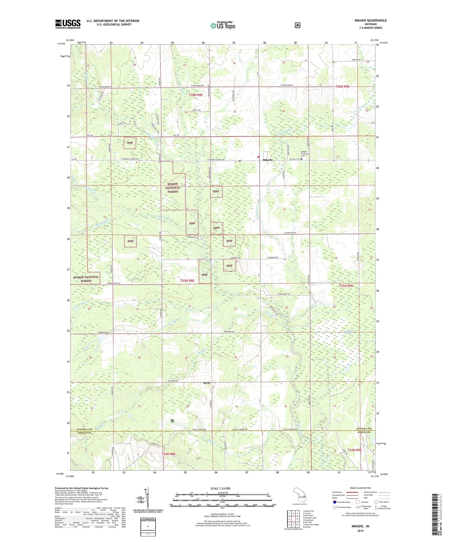
2019 topographic map quadrangle Mikado in the state of Michigan. Scale: 1:24000. Based on the newly updated USGS 7.5' US Topo map series, this map is in the following counties: Alcona, Iosco. The map contains contour data, water features, and other items you are used to seeing on USGS maps, but also has updated roads and other features. This is the next generation of topographic maps. Printed on high-quality waterproof paper with UV fade-resistant inks.
Quads adjacent to this one:
West: Sprinkler Lake
Northwest: Barton City
North: Lincoln
Northeast: Harrisville
East: Greenbush
Southeast: Oscoda
South: Foote Site Village
Southwest: Sid Town
Contains the following named places: Alpena State Forest, Alvin, Alvin Post Office, Backus Creek, Bruce Park, Calvary Church, Coppler Creek, County Line School, Duval Creek, East Branch Pine River, Gimlet Creek, Grey Creek, Hill Creek, McDonald Creek, McGillis Creek, Mikado, Mikado Branch Library, Mikado Post Office, Mikado Station, Mikado Township Cemetery, Mikado Township Volunteer Fire Department, Oscoda Indian Mission, Reorganized Church, Roy Creek, Roy Post Office, Roy Station, Saint Raphael Church, South Branch Pine River, Van Etten Creek, West Branch Pine River, WXJD-FM (Oscoda), ZIP Code: 48745