MyTopo
Muskallonge Lake East Michigan US Topo Map
Couldn't load pickup availability
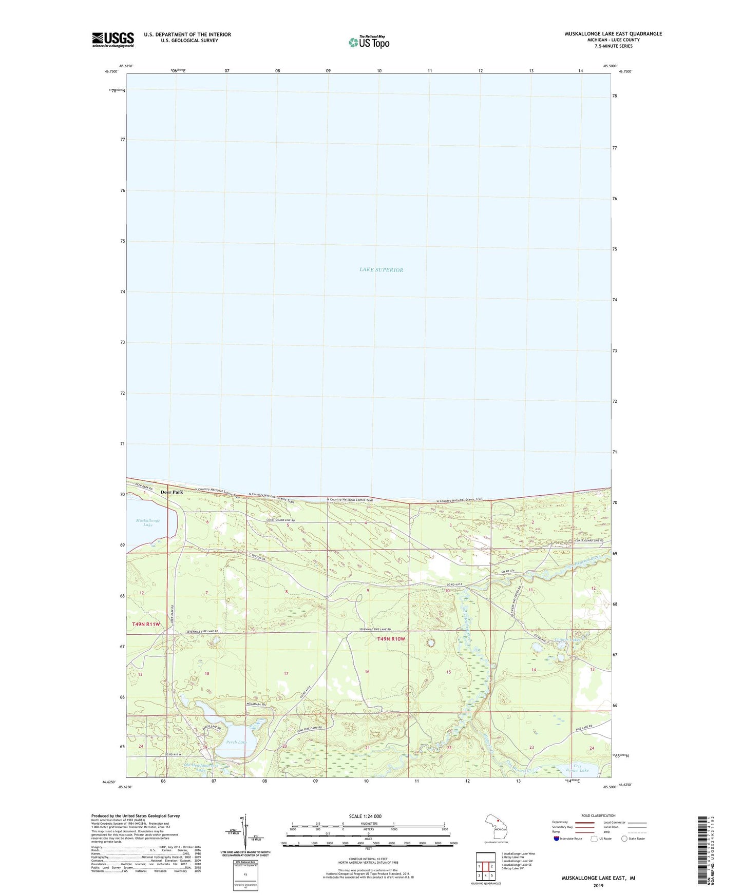
2023 topographic map quadrangle Muskallonge Lake East in the state of Michigan. Scale: 1:24000. Based on the newly updated USGS 7.5' US Topo map series, this map is in the following counties: Luce. The map contains contour data, water features, and other items you are used to seeing on USGS maps, but also has updated roads and other features. This is the next generation of topographic maps. Printed on high-quality waterproof paper with UV fade-resistant inks.
Quads adjacent to this one:
West: Muskallonge Lake West
East: Betsy Lake NW
Southeast: Betsy Lake SW
South: Muskallonge Lake SE
Southwest: Muskallonge Lake SW
This map covers the same area as the classic USGS quad with code o46085f5.
Contains the following named places: Connor Lakes, Cris Brown Creek, Cris Brown Lake, Deer Park, Deer Park Station, Deerpark Post Office, Lake Superior State Forest, Luce County, Perch Lake, Perch Lake State Forest and Campground, Reed and Green Bridge Campground, Wabash Creek