MyTopo
Naubinway Michigan US Topo Map
Couldn't load pickup availability
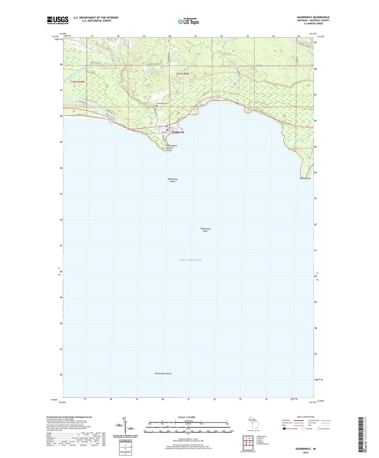
2023 topographic map quadrangle Naubinway in the state of Michigan. Scale: 1:24000. Based on the newly updated USGS 7.5' US Topo map series, this map is in the following counties: Mackinac. The map contains contour data, water features, and other items you are used to seeing on USGS maps, but also has updated roads and other features. This is the next generation of topographic maps. Printed on high-quality waterproof paper with UV fade-resistant inks.
Quads adjacent to this one:
West: Engadine
Northwest: Millecoquins
North: Gilchrist
Northeast: Garnet
East: Hog Island Point
This map covers the same area as the classic USGS quad with code o46085a4.
Contains the following named places: Biddle Point, East Mile Creek, Elbow Lake, Garfield Township Fire Department Station 2, Hiawatha Golf Club, Lower Millecoquins River, Mackinac Straits Medical Clinic, Mattix Creek, Michigan Department of Natural Resources Naubinway Field Office, Millecoquins Point, Millecoquins Reefs, Naubinway, Naubinway Cemetery, Naubinway Census Designated Place, Naubinway Christian Fellowship, Naubinway Island, Naubinway Island Light, Naubinway Post Office, Naubinway Reef, Naubinway Rest Area, Northernmost Point of Lake Michigan Historical Marker, Threemile Creek, West Mile Creek