MyTopo
Engadine Michigan US Topo Map
Couldn't load pickup availability
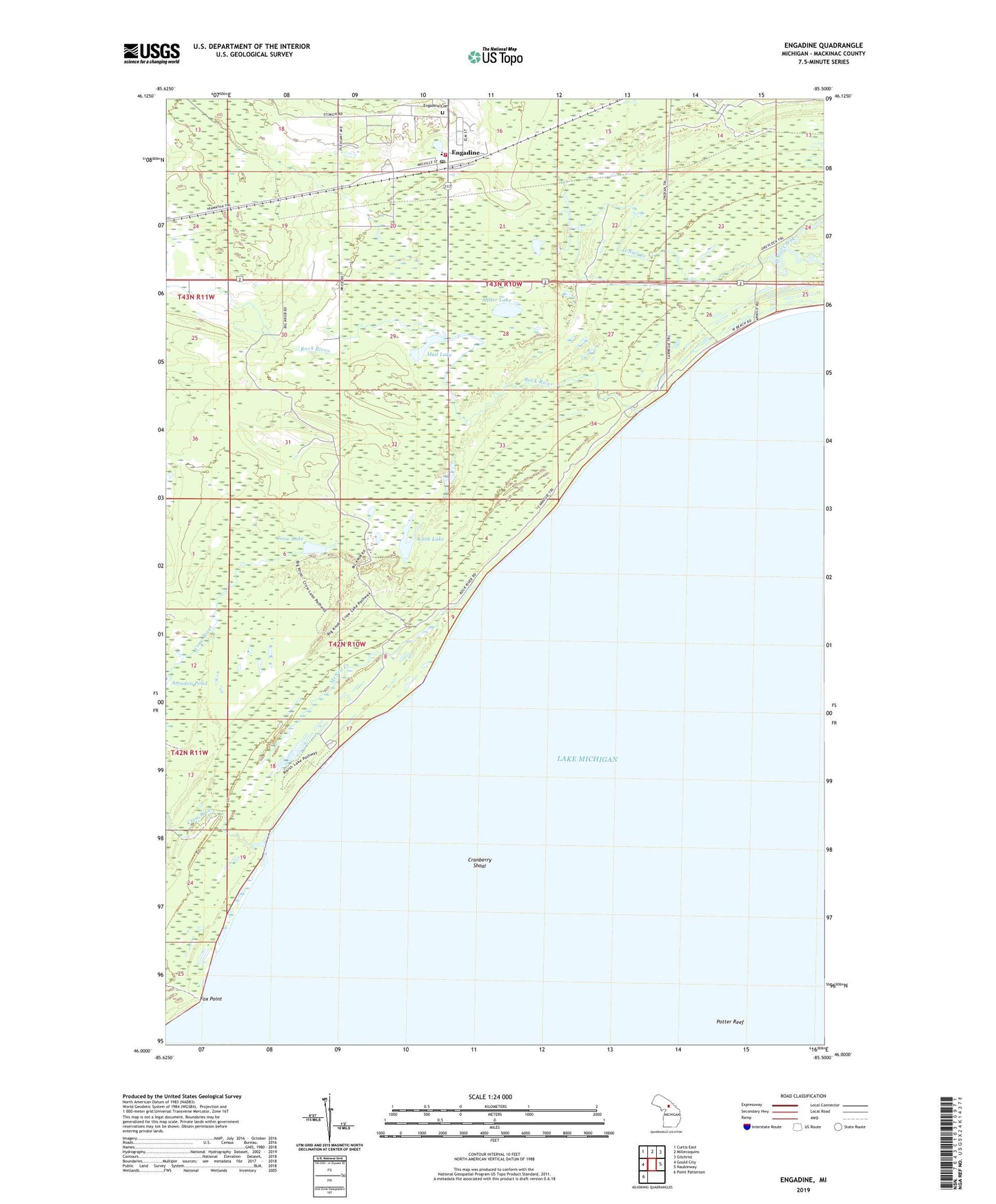
2023 topographic map quadrangle Engadine in the state of Michigan. Scale: 1:24000. Based on the newly updated USGS 7.5' US Topo map series, this map is in the following counties: Mackinac. The map contains contour data, water features, and other items you are used to seeing on USGS maps, but also has updated roads and other features. This is the next generation of topographic maps. Printed on high-quality waterproof paper with UV fade-resistant inks.
Quads adjacent to this one:
West: Gould City
Northwest: Curtis East
North: Millecoquins
Northeast: Gilchrist
East: Naubinway
Southwest: Point Patterson
This map covers the same area as the classic USGS quad with code o46085a5.
Contains the following named places: Big Knob Campground, Cranberry Shoal, Crow Lake, Engadine, Engadine Cemetery, Engadine Consolidated Schools, Engadine Post Office, Engadine Station, Engadine United Methodist Church, Fox Point, Garfield Township Ambulance Service, Garfield Township Fire Department, Garfield Township Park, Knob Lake, McNeil Creek, Miller Lake, Mud Lake, O'Niel Creek, Our Lady of Lourdes Catholic Church, Potter Reef, Rock River, Salzeider Community Recreation Center, Swift Siding, West Mackinac Health Clinic