
MyTopo
Northland NW Michigan US Topo Map
Couldn't load pickup availability
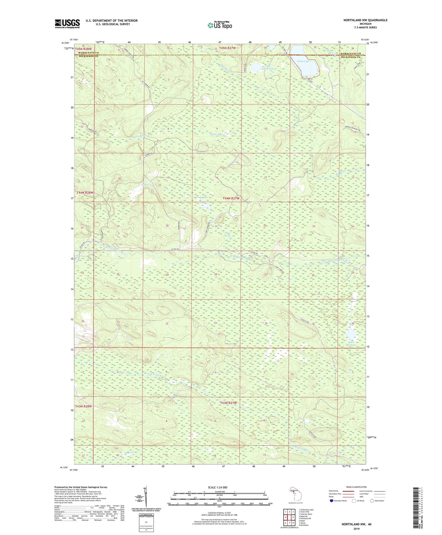
2019 topographic map quadrangle Northland NW in the state of Michigan. Scale: 1:24000. Based on the newly updated USGS 7.5' US Topo map series, this map is in the following counties: Dickinson, Marquette. The map contains contour data, water features, and other items you are used to seeing on USGS maps, but also has updated roads and other features. This is the next generation of topographic maps. Printed on high-quality waterproof paper with UV fade-resistant inks.
Quads adjacent to this one:
West: Ralph NE
Northwest: Chabeneau Lake
North: Green Hills
Northeast: Cataract Basin
East: Northland NE
Southeast: Northland
South: Alfred
Southwest: Ralph
Contains the following named places: Cady Creek, Cady Lake, Camp Sanford, Kates Lake, Kemp Lake, Lake Thirtysix, Little Brook, Little Kates Lake, Lower Dam Campground, McGregor Creek, Township of West Branch, West Branch State Forest Campground, ZIP Code: 49877


