MyTopo
Green Hills Michigan US Topo Map
Couldn't load pickup availability
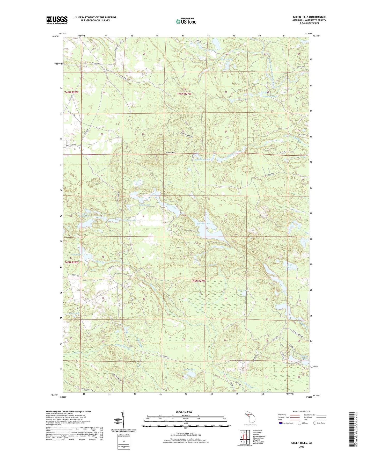
2023 topographic map quadrangle Green Hills in the state of Michigan. Scale: 1:24000. Based on the newly updated USGS 7.5' US Topo map series, this map is in the following counties: Marquette. The map contains contour data, water features, and other items you are used to seeing on USGS maps, but also has updated roads and other features. This is the next generation of topographic maps. Printed on high-quality waterproof paper with UV fade-resistant inks.
Quads adjacent to this one:
West: Chabeneau Lake
Northwest: Greenwood
North: Ishpeming
Northeast: Palmer
East: Cataract Basin
Southeast: Northland NE
South: Northland NW
Southwest: Ralph NE
This map covers the same area as the classic USGS quad with code o46087c6.
Contains the following named places: Bass Creek, Bear Lake, Big Bass Lake, Birch Lake, Boot Lake, Camp Eleven Creek, Chain Lakes, Charley Lakes, Clear Creek, Crescent Lake, Drake Lake, East Voelker Lake, Erickson Lake, Green Hills, Hawkins Ponds, Hay Lake, Hemmings Lake, Horseshoe Lake, Hurt Lake, Kidney Lake, Little Bass Lake, Little Drake Lake, Lone Pine Lake, Pilliot Lake, Spear Lake, Township of Tilden, Trout Lake, Voelker Lake