MyTopo
Orangeville Michigan US Topo Map
Couldn't load pickup availability
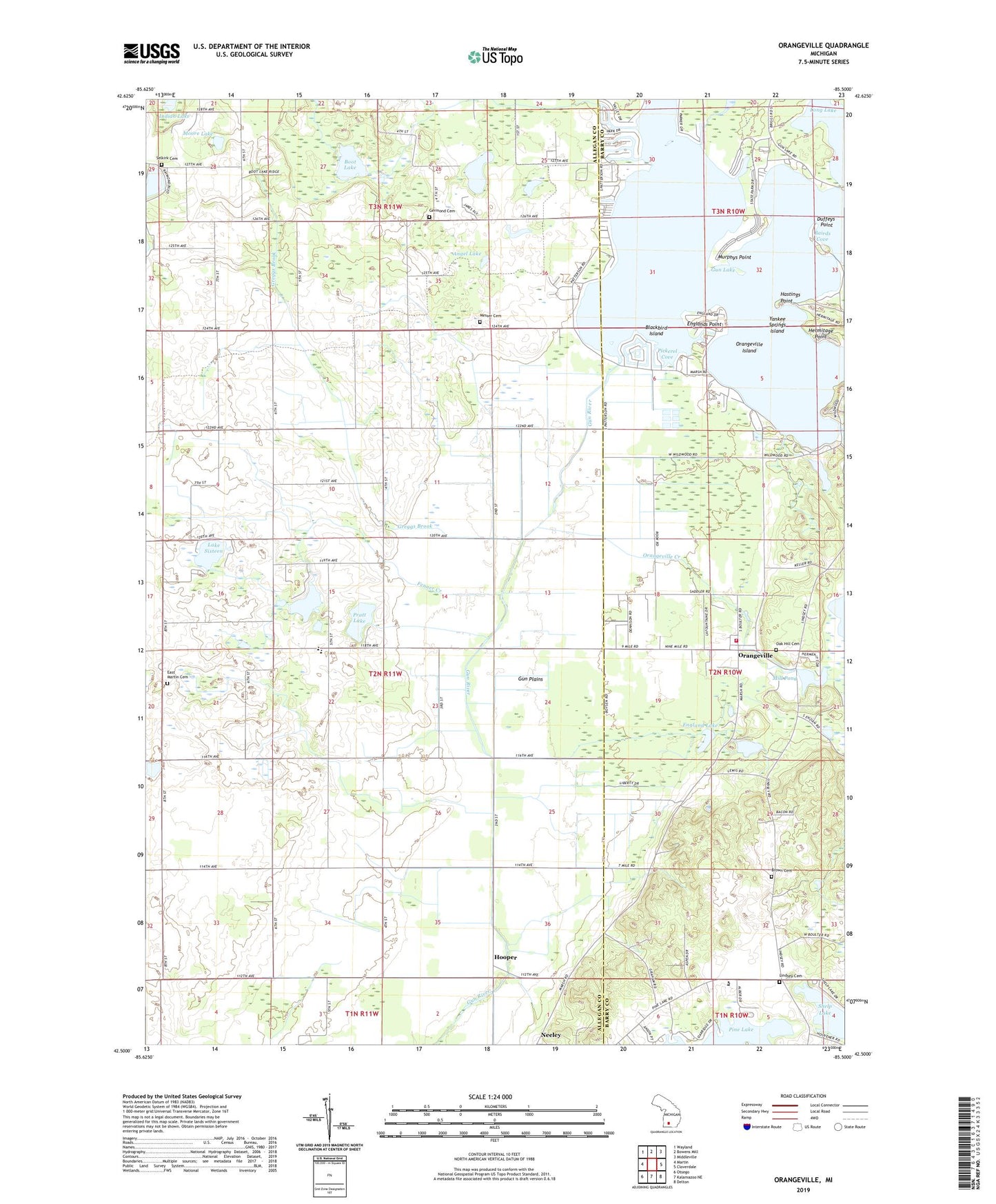
2019 topographic map quadrangle Orangeville in the state of Michigan. Scale: 1:24000. Based on the newly updated USGS 7.5' US Topo map series, this map is in the following counties: Allegan, Barry. The map contains contour data, water features, and other items you are used to seeing on USGS maps, but also has updated roads and other features. This is the next generation of topographic maps. Printed on high-quality waterproof paper with UV fade-resistant inks.
Quads adjacent to this one:
West: Martin
Northwest: Wayland
North: Bowens Mill
Northeast: Middleville
East: Cloverdale
Southeast: Delton
South: Kalamazoo NE
Southwest: Otsego
Contains the following named places: Angel Lake, Apostolic Assembly Church, Bairds Cove, Blackbird Island, Boot Lake, Bradley Church, Bradley Indian Mission Cemetery, Brown Cemetery, Chicago Point, Duffeys Point, East Martin, East Martin Cemetery, East Martin Christian High School, East Martin Christian Reformed Church, England Lake, Englands Point, Fenner Creek, Fenner Lake, Germond Cemetery, Greggs Brook, Gun Lake, Gun Lake Chapel, Gun Plains, Gunlake Post Office, Hastings Point, Hermitage Point, Hooper, Hooper Post Office, Hooper Station, House of Prayer Church, Indian Lake, Lake Sixteen, Lindsey Cemetery, Long Lake, Messer Cemetery, Mill Pond, Moore Lake, Murphys Point, Neeley, North Pine Lake School, Oak Hill Cemetery, Orangeville, Orangeville Baptist Church, Orangeville Creek, Orangeville Island, Orangeville Post Office, Orangeville Township Fire Department, Orchard Hills Golf Course, Parkside Park Campground, Pickerel Cove, Pratt Lake, Round Lake, Saint Francis Church, Selkirk Family Cemetery, Shelbyville Post Office, Shelp Lake, Township of Martin, Veterans Vocational School, Yankee Springs Island, ZIP Code: 49344