MyTopo
Kalamazoo NE Michigan US Topo Map
Couldn't load pickup availability
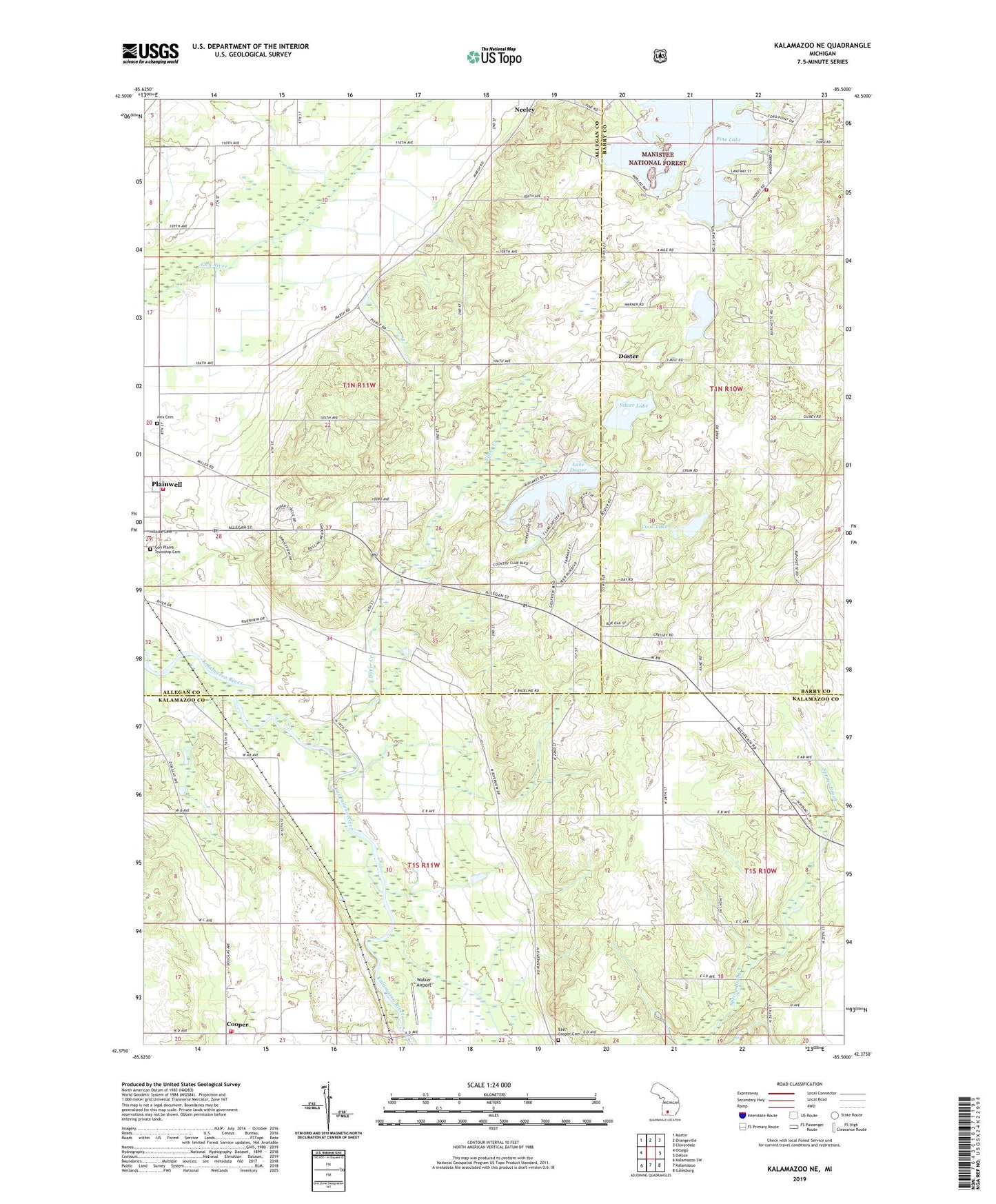
2023 topographic map quadrangle Kalamazoo NE in the state of Michigan. Scale: 1:24000. Based on the newly updated USGS 7.5' US Topo map series, this map is in the following counties: Kalamazoo, Allegan, Barry. The map contains contour data, water features, and other items you are used to seeing on USGS maps, but also has updated roads and other features. This is the next generation of topographic maps. Printed on high-quality waterproof paper with UV fade-resistant inks.
Quads adjacent to this one:
West: Otsego
Northwest: Martin
North: Orangeville
Northeast: Cloverdale
East: Delton
Southeast: Galesburg
South: Kalamazoo
Southwest: Kalamazoo SW
This map covers the same area as the classic USGS quad with code o42085d5.
Contains the following named places: Camp Merrie Wood, Canaanland Church of God, Charter Township of Cooper, Cook Lake, Cooper, Cooper Post Office, Cooper Station, Cooper Township Fire Department Station 1, Doster, Doster Church, Doster Post Office, Doster Station, East Cooper Cemetery, Evergreen Park Mobile Home Park, Gun Plain Charter Township Fire Department, Gun Plains Township Cemetery, Hillside Cemetery, Ives Cemetery, Lake Doster, Lake Doster Golf Club, Lighthouse Baptist Church, Pine Lake, Plainwell Pines Nursing Center, Prairieville Township Fire Department, Silver Creek, Silver Lake, Silvercreek Post Office, Township of Gun Plain, Walker Airport, Warner Lake, WMUK-FM (Kalamazoo), ZIP Code: 49080