MyTopo
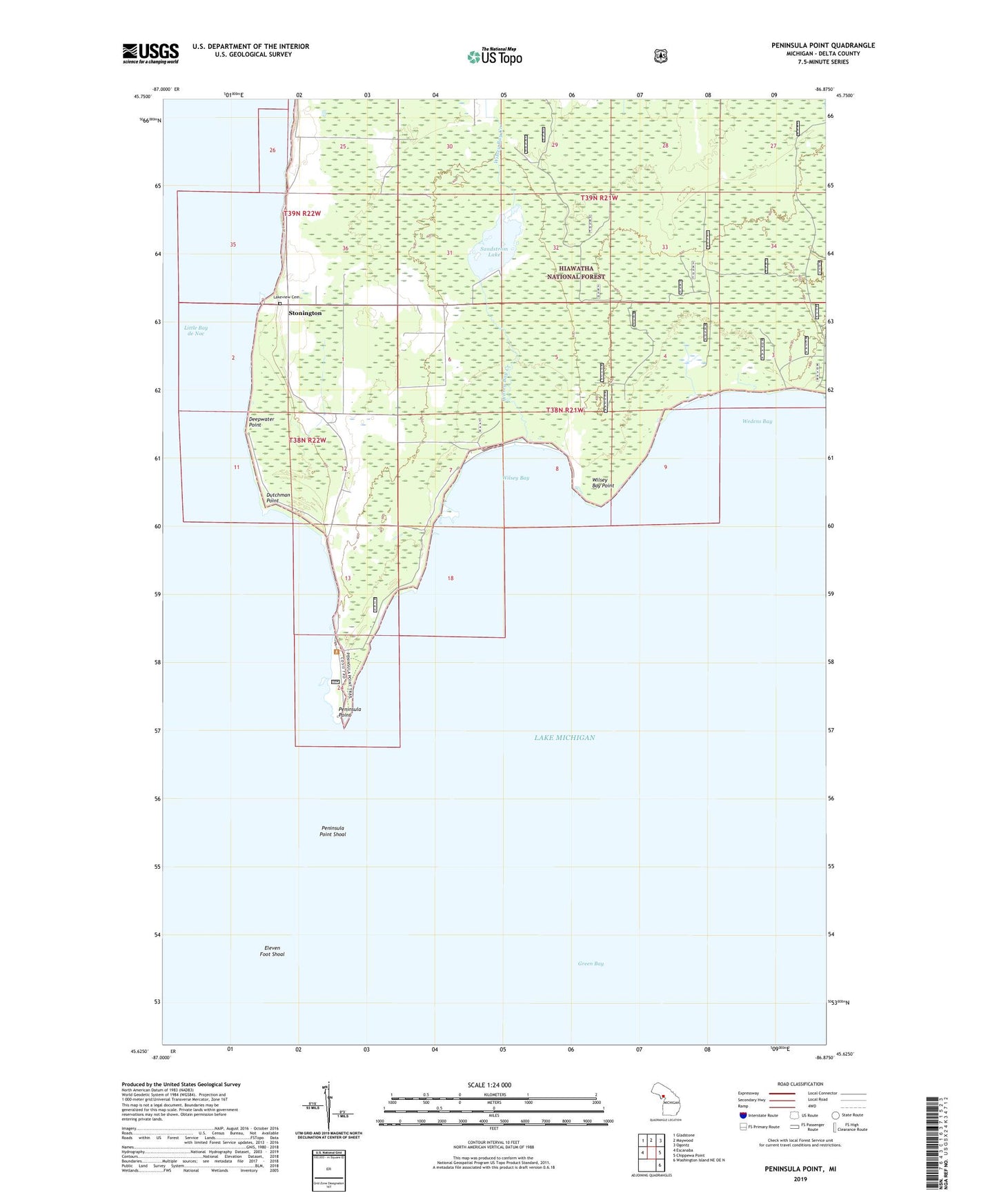
Peninsula Point Michigan US Topo Map
Couldn't load pickup availability
Also explore the Peninsula Point Forest Service Topo of this same quad for updated USFS data
2023 topographic map quadrangle Peninsula Point in the state of Michigan. Scale: 1:24000. Based on the newly updated USGS 7.5' US Topo map series, this map is in the following counties: Delta. The map contains contour data, water features, and other items you are used to seeing on USGS maps, but also has updated roads and other features. This is the next generation of topographic maps. Printed on high-quality waterproof paper with UV fade-resistant inks.
Quads adjacent to this one:
West: Escanaba
Northwest: Gladstone
North: Maywood
Northeast: Ogontz
East: Chippewa Point
Southeast: Washington Island NE OE N
This map covers the same area as the classic USGS quad with code o45086f8.
Contains the following named places: Deepwater Point, Dutchman Point, Eleven Foot Shoal, Lakeview Cemetery, Peninsula Point, Peninsula Point Recreation Area, Peninsula Point Shoal, Sandstrom Lake, Stonington, Stonington Post Office, Trinity Church, Wedens Bay, Wilsey Bay, Wilsey Bay Creek, Wilsey Bay Point