
MyTopo
Perkins Michigan US Topo Map
Couldn't load pickup availability
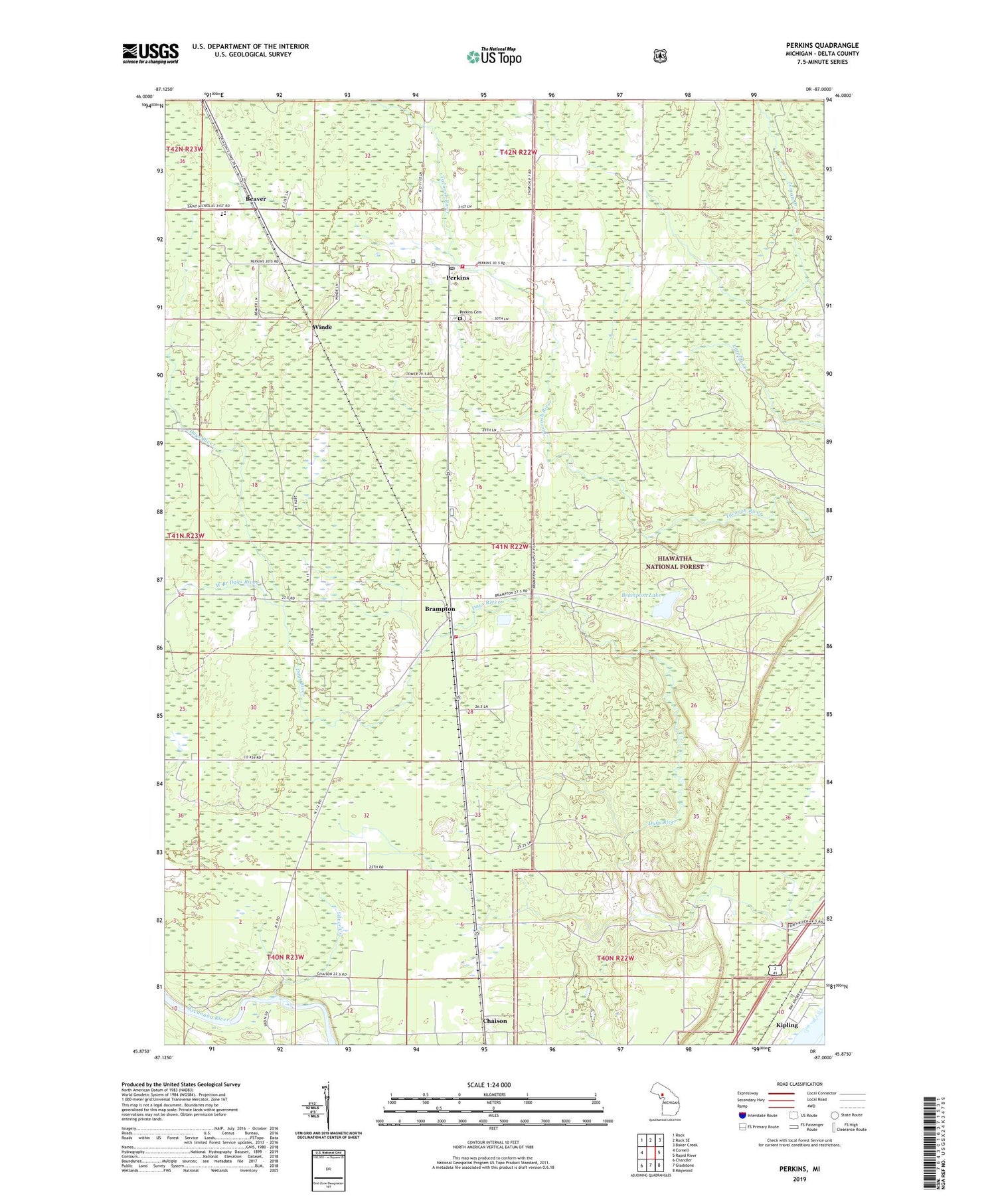
2019 topographic map quadrangle Perkins in the state of Michigan. Scale: 1:24000. Based on the newly updated USGS 7.5' US Topo map series, this map is in the following counties: Delta. The map contains contour data, water features, and other items you are used to seeing on USGS maps, but also has updated roads and other features. This is the next generation of topographic maps. Printed on high-quality waterproof paper with UV fade-resistant inks.
Quads adjacent to this one:
West: Cornell
Northwest: Rock
North: Rock SE
Northeast: Baker Creek
East: Rapid River
Southeast: Maywood
South: Gladstone
Southwest: Chandler
Contains the following named places: Baldwin Township Volunteer Fire Department, Beaver, Bethany Church, Brampton, Brampton Lake, Brampton Post Office, Brampton Station, Brampton Township Volunteer Fire Department Station 1, Chaison, Gladstone Golf Club, Gladstone Ski Park, Mid Peninsula School, Perkins, Perkins Cemetery, Perkins Post Office, Perkins Station, Saint Josephs Church, Silver Creek, Township of Baldwin, Township of Brampton, West Branch Days River, Winde, Winde Post Office, Winde Station


