MyTopo
Cornell Michigan US Topo Map
Couldn't load pickup availability
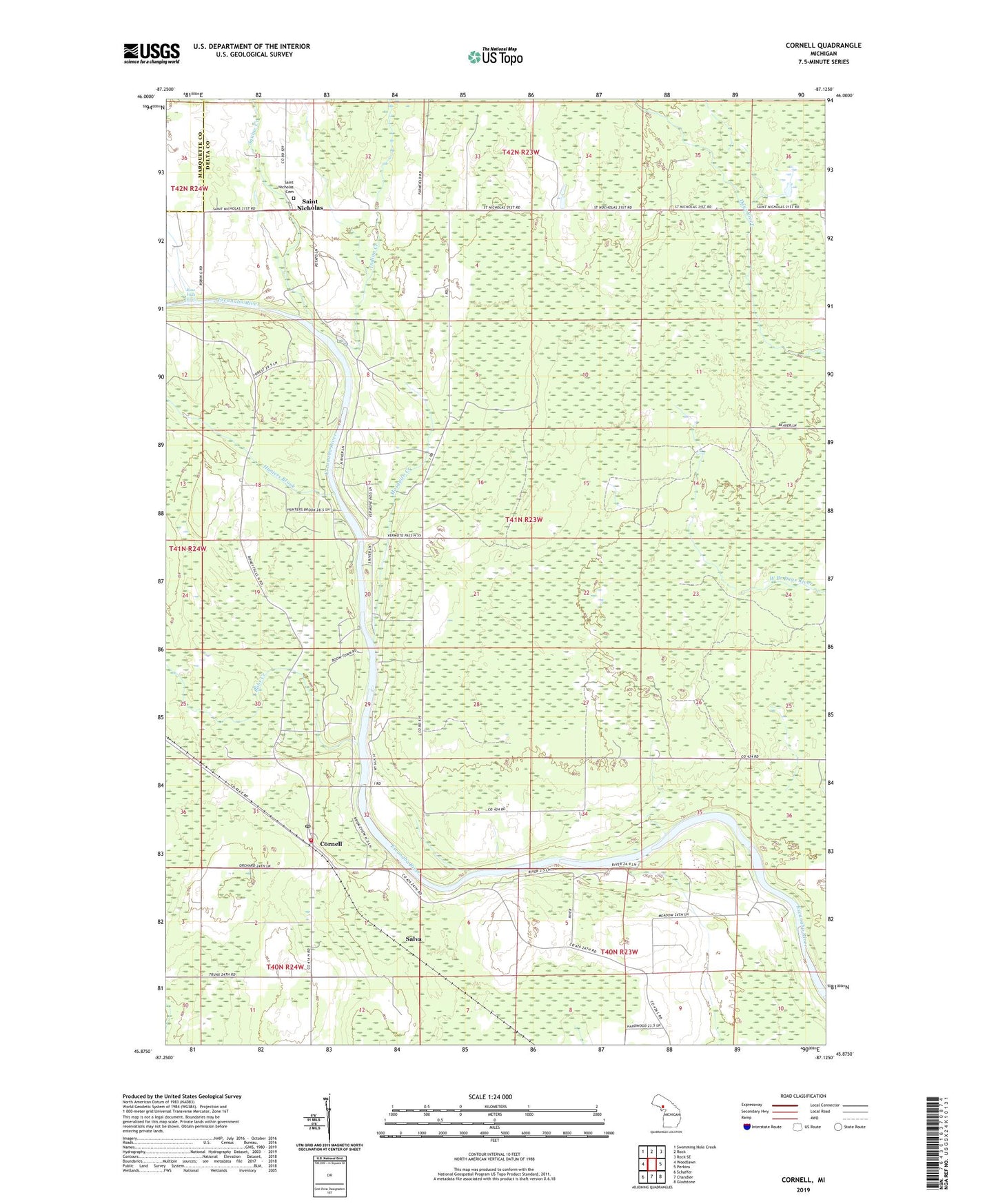
2023 topographic map quadrangle Cornell in the state of Michigan. Scale: 1:24000. Based on the newly updated USGS 7.5' US Topo map series, this map is in the following counties: Delta, Marquette. The map contains contour data, water features, and other items you are used to seeing on USGS maps, but also has updated roads and other features. This is the next generation of topographic maps. Printed on high-quality waterproof paper with UV fade-resistant inks.
Quads adjacent to this one:
West: Woodlawn
Northwest: Swimming Hole Creek
North: Rock
Northeast: Rock SE
East: Perkins
Southeast: Gladstone
South: Chandler
Southwest: Schaffer
This map covers the same area as the classic USGS quad with code o45087h2.
Contains the following named places: Bobs Creek, Cornell, Cornell Post Office, Cornell Station, Cornell Twp. Volunteer Fire Department, Hunters Brook, Indian Creek, Mosquito Creek, Rose Falls (East), Saint Nicholas, Saint Nicholas Cemetery, Salva, Squaw Creek