MyTopo
Rock Michigan US Topo Map
Couldn't load pickup availability
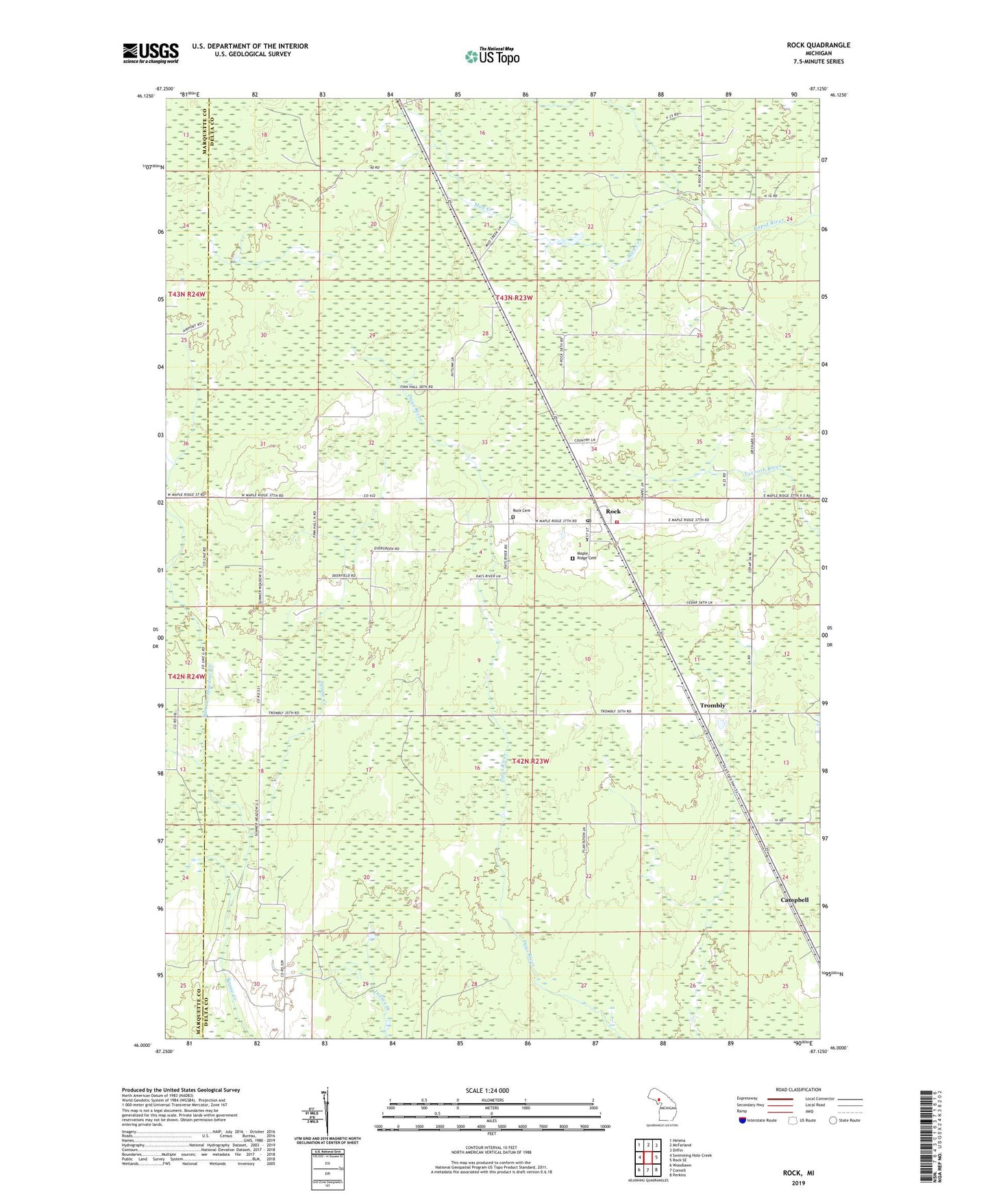
2023 topographic map quadrangle Rock in the state of Michigan. Scale: 1:24000. Based on the newly updated USGS 7.5' US Topo map series, this map is in the following counties: Delta, Marquette. The map contains contour data, water features, and other items you are used to seeing on USGS maps, but also has updated roads and other features. This is the next generation of topographic maps. Printed on high-quality waterproof paper with UV fade-resistant inks.
Quads adjacent to this one:
West: Swimming Hole Creek
Northwest: Helena
North: McFarland
Northeast: Diffin
East: Rock SE
Southeast: Perkins
South: Cornell
Southwest: Woodlawn
This map covers the same area as the classic USGS quad with code o46087a2.
Contains the following named places: Campbell, Defiance Post Office, Defiance Station, Maple Ridge Cemetery, Mud Creek, Rock, Rock Bible Chapel, Rock Cemetery, Rock Census Designated Place, Rock Post Office, Rock Rescue Emergency Medical Services, Rock Station, Summer Meadow Creek, Township of Maple Ridge, Tri - Township Fire Department Station 1, Trombly, ZIP Code: 49880