
MyTopo
Phoenix Michigan US Topo Map
Couldn't load pickup availability
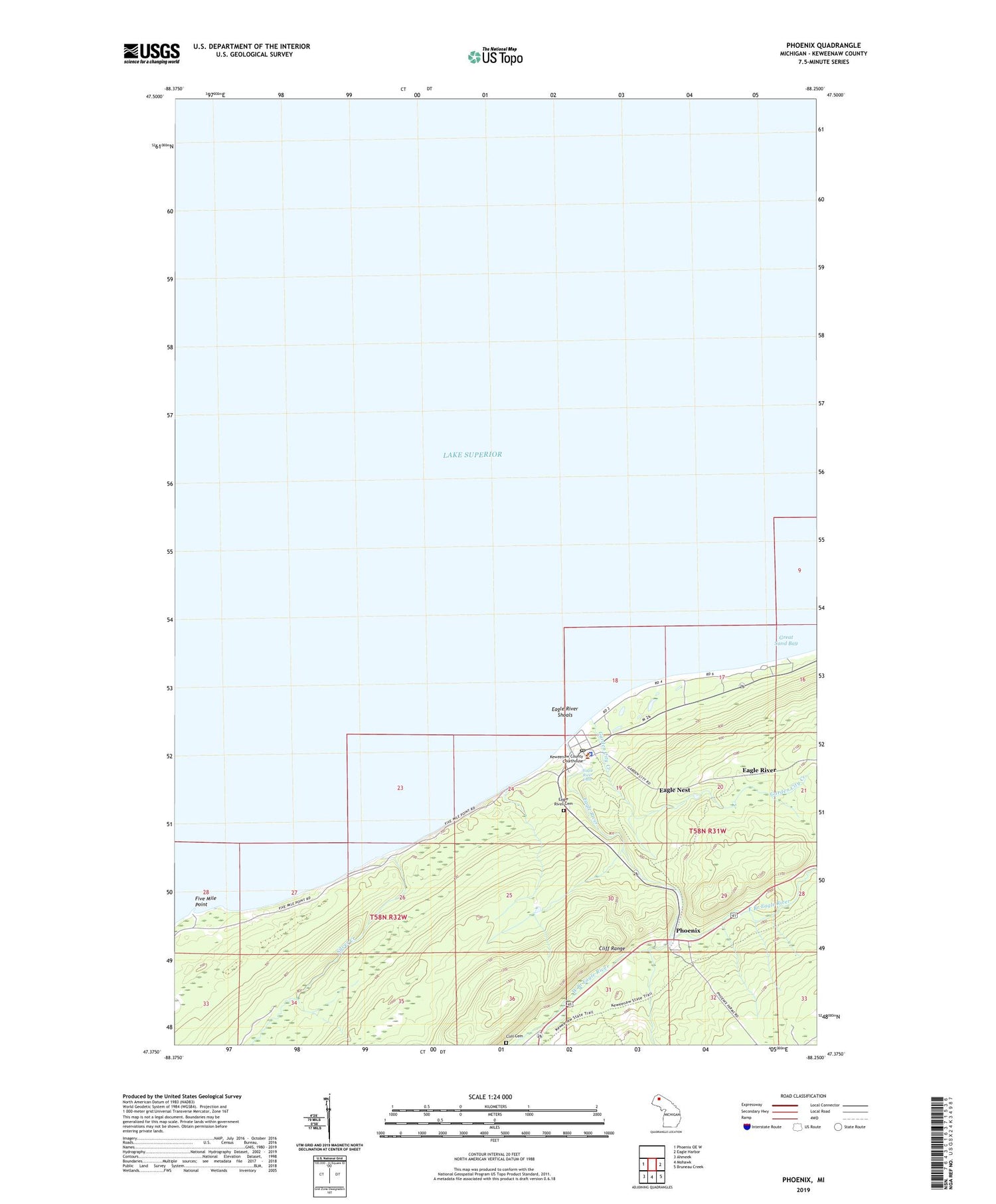
2019 topographic map quadrangle Phoenix in the state of Michigan. Scale: 1:24000. Based on the newly updated USGS 7.5' US Topo map series, this map is in the following counties: Keweenaw. The map contains contour data, water features, and other items you are used to seeing on USGS maps, but also has updated roads and other features. This is the next generation of topographic maps. Printed on high-quality waterproof paper with UV fade-resistant inks.
Quads adjacent to this one:
West: Phoenix OE W
East: Eagle Harbor
Southeast: Bruneau Creek
South: Mohawk
Southwest: Ahmeek
Contains the following named places: Cliff Cemetery, Clifton Post Office, Eagle Nest, Eagle River, Eagle River Cemetery, Eagle River Census Designated Place, Eagle River Falls, Eagle River Historical Marker, Eagle River Lighthouse, Eagle River Post Office, Eagle River Shoals, East Branch Eagle River, Five Mile Point, Garden City Creek, Keweenaw County Sheriff's Office, Lake Shore Drive Bridge Historical Marker, Phoenix, Phoenix Post Office, Phoenix Station, Sand Hills Lighthouse, Silver Creek, Vaughnsville, West Branch Eagle River


