MyTopo
Ahmeek Michigan US Topo Map
Couldn't load pickup availability
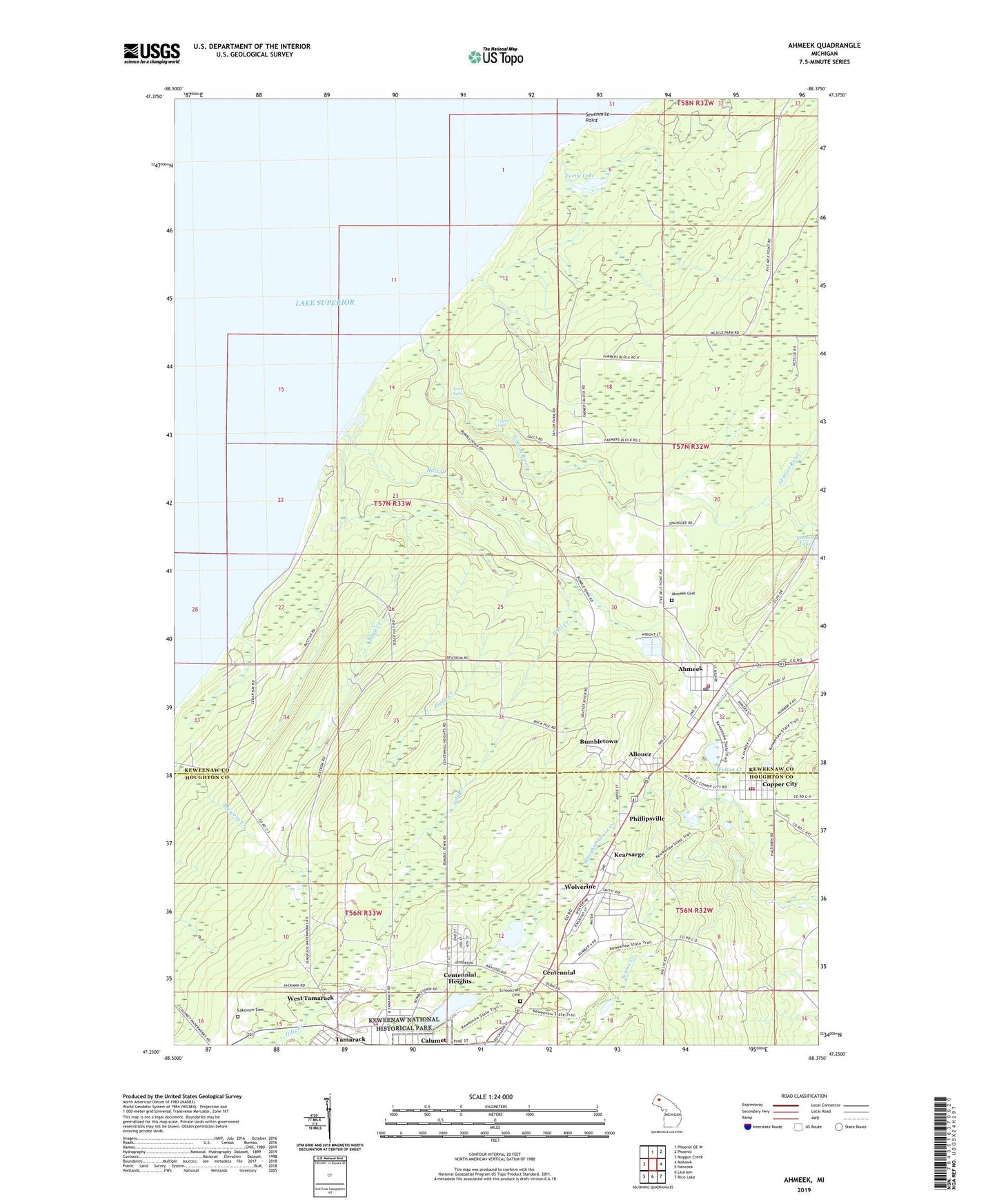
2023 topographic map quadrangle Ahmeek in the state of Michigan. Scale: 1:24000. Based on the newly updated USGS 7.5' US Topo map series, this map is in the following counties: Keweenaw, Houghton. The map contains contour data, water features, and other items you are used to seeing on USGS maps, but also has updated roads and other features. This is the next generation of topographic maps. Printed on high-quality waterproof paper with UV fade-resistant inks.
Quads adjacent to this one:
West: Muggun Creek
North: Phoenix OE W
Northeast: Phoenix
East: Mohawk
Southeast: Rice Lake
South: Laurium
Southwest: Hancock
This map covers the same area as the classic USGS quad with code o47088c4.
Contains the following named places: Ahmeek, Ahmeek Cemetery, Ahmeek Fire Department, Ahmeek Mine, Ahmeek Post Office, Ahmeek Station, Ahmeek Townhall, Allouez, Allouez Post Office, Allouez Station, Allouez Township Community Center, Black Creek, Bumbletown, Calumet Lake, Centennial, Centennial Heights, Charter Township of Calumet, Copper City, Copper City Post Office, Copper City Station, Copper City Volunteer Fire Department, Finey Creek, Fulton Creek, Gratiot River, Hills Creek, Kearsage Post Office, Kearsage Station, Kearsarge, Lake Shore School, Lakeview, Lakeview Cemetery, Lower Falls, Phillipsville, Red Jacket Mine, Schoolcraft Cemetery, Sevenmile Point, Slaughterhouse Creek, Township of Allouez, Turtle Lake, Upper Falls, Village of Ahmeek, Village of Copper City, West Tamarack, Wolverine, ZIP Codes: 49901, 49942