MyTopo
Pleasant Valley Michigan US Topo Map
Couldn't load pickup availability
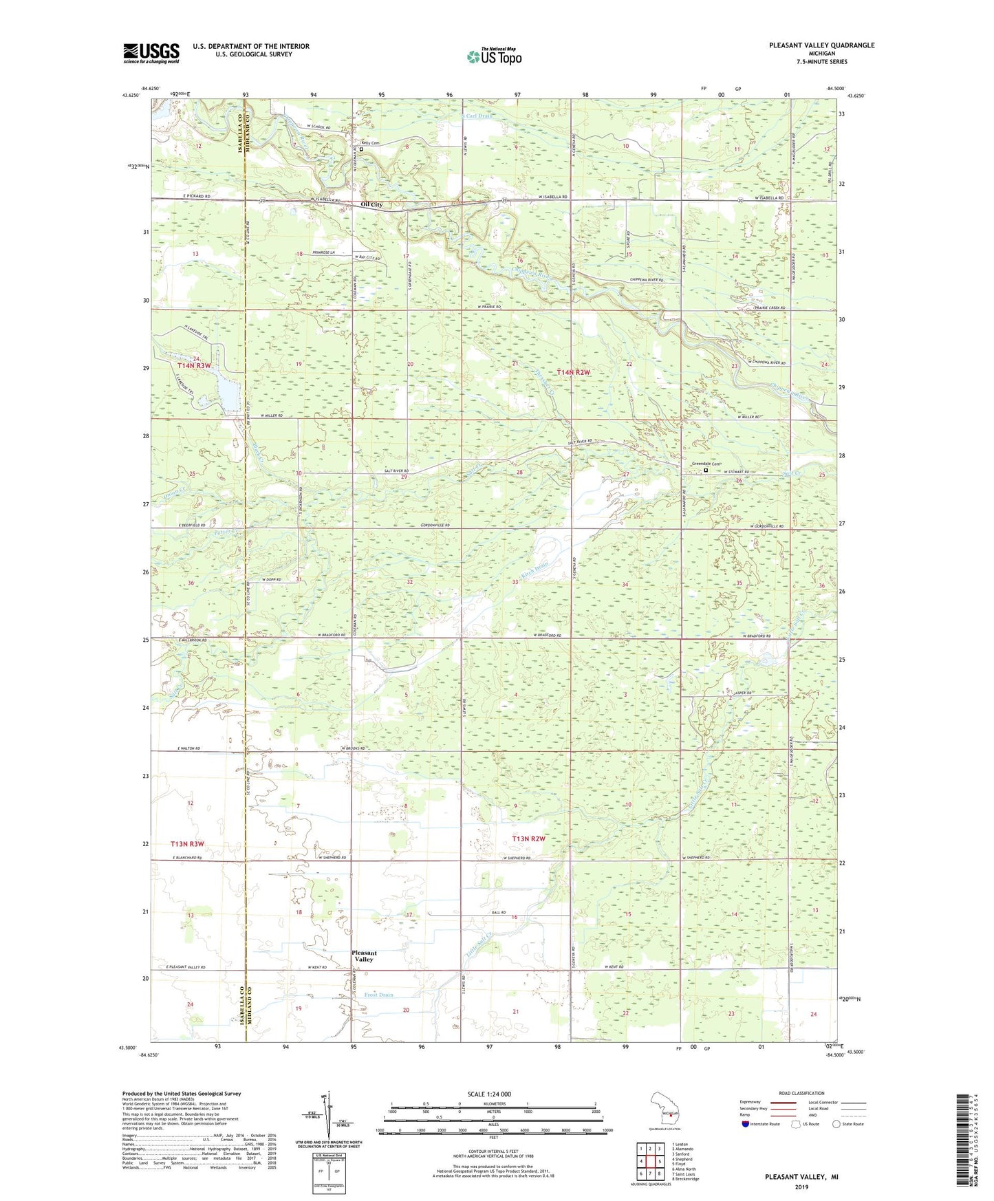
2019 topographic map quadrangle Pleasant Valley in the state of Michigan. Scale: 1:24000. Based on the newly updated USGS 7.5' US Topo map series, this map is in the following counties: Midland, Isabella. The map contains contour data, water features, and other items you are used to seeing on USGS maps, but also has updated roads and other features. This is the next generation of topographic maps. Printed on high-quality waterproof paper with UV fade-resistant inks.
Quads adjacent to this one:
West: Shepherd
Northwest: Leaton
North: Alamando
Northeast: Sanford
East: Floyd
Southeast: Breckenridge
South: Saint Louis
Southwest: Alma North
Contains the following named places: Black Creek, Bucks Run Golf Club, Camelot Lake, Davis Drain, Frost Drain, Glad Tidings Church, Greendale Church, Greendale Township Cemetery, Kelly Cemetery, Kirch Drain, Martin Luther Institute, Mount Pleasant Oil Field, Oil City, Oil City Assembly of God Church, Onion Creek, Pleasant Valley, Pleasant Valley Post Office, Pleasant View School, Porter Oil Field, Potter Creek, Salt River Church, Salt Rivers Acres Campground, Thrasher Creek, Township of Greendale, Township of Jasper, WUGN-FM (Midland)