MyTopo
Sanford Michigan US Topo Map
Couldn't load pickup availability
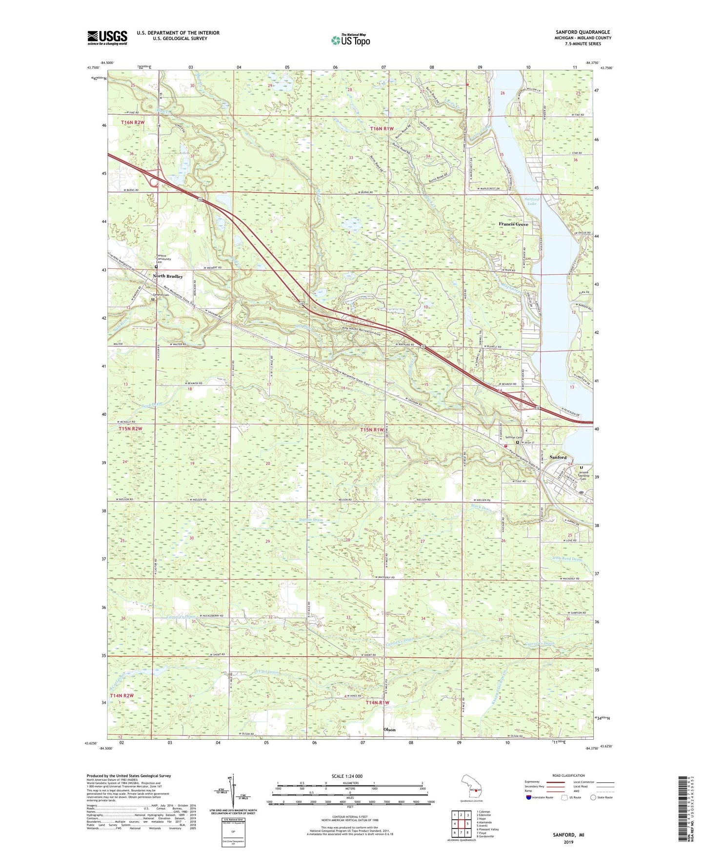
2023 topographic map quadrangle Sanford in the state of Michigan. Scale: 1:24000. Based on the newly updated USGS 7.5' US Topo map series, this map is in the following counties: Midland. The map contains contour data, water features, and other items you are used to seeing on USGS maps, but also has updated roads and other features. This is the next generation of topographic maps. Printed on high-quality waterproof paper with UV fade-resistant inks.
Quads adjacent to this one:
West: Alamando
Northwest: Coleman
North: Edenville
Northeast: Hope
East: Averill
Southeast: Gordonville
South: Floyd
Southwest: Pleasant Valley
This map covers the same area as the classic USGS quad with code o43084f4.
Contains the following named places: Black Creek, Black Creek Forest Campground, Black Drain, Bluff Creek, Church of Christ Restored, Church of Jesus Christ of Latter Day Saints, Cleft of the Rock Family Church, Community of Christ, Durbin Drain, Edenville Fire and Rescue Station 2, Francis Grove, Geneva Cemetery, Geneva Community Cemetery, Jerome Township Cemetery, Jerome Township Fire Department Station 1, Jerome Township Hall, Midland County, Mud Creek, North Bradley, North Bradley Church of God, North Bradley Post Office, North Bradley Station, Olson, Olson Community Church, Olson Post Office, Origins of the Salt Industry Historical Marker, Saint Agnes Roman Catholic Church, Salt River, Sanford, Sanford Historical Museum, Sanford Lake, Sanford Lake Marina, Sanford Lake Park, Sanford Medical Center, Sanford Post Office, Sanford School, Sanford Station, Sanford United Methodist Church, State Salt Well Number 1 Historical Marker, Stockholm Forest Village Mobile Home Park, Sullivan Cemetery, Township of Jerome, Varity Creek, Veterans Memorial Park, Village of Sanford, ZIP Code: 48657