MyTopo
Floyd Michigan US Topo Map
Couldn't load pickup availability
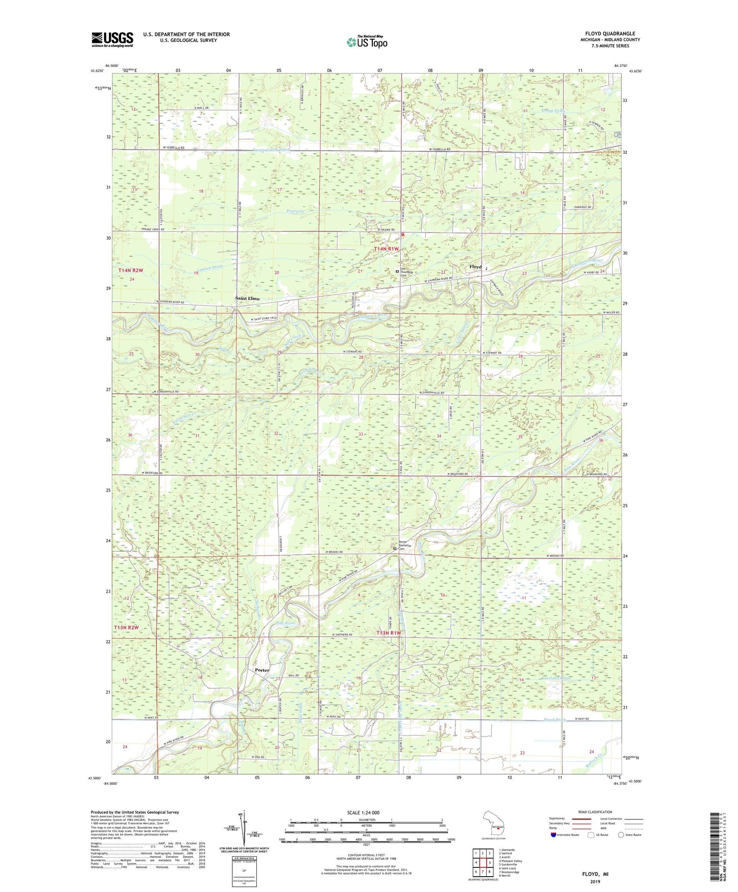
2023 topographic map quadrangle Floyd in the state of Michigan. Scale: 1:24000. Based on the newly updated USGS 7.5' US Topo map series, this map is in the following counties: Midland. The map contains contour data, water features, and other items you are used to seeing on USGS maps, but also has updated roads and other features. This is the next generation of topographic maps. Printed on high-quality waterproof paper with UV fade-resistant inks.
Quads adjacent to this one:
West: Pleasant Valley
Northwest: Alamando
North: Sanford
Northeast: Averill
East: Gordonville
Southeast: Merrill
South: Breckenridge
Southwest: Saint Louis
This map covers the same area as the classic USGS quad with code o43084e4.
Contains the following named places: Baker Drain, Brue Drain, Bush Creek, Dowd Drain, Floyd, Floyd Church of God, Floyd Elementary School, Floyd Post Office, Hoxie Drain, Huber Drain, Knapp Cutoff Drain, Kneeland Drain, Lawson Drain, Lee Township Cemetery, Lee Township Fire Department, Little Salt Creek, Midland Church, Midland Missionary Church, Porter, Porter Free Methodist Church, Porter Oil Field, Porter Post Office, Porter Township Cemetery, River Ridge Campground, Saint Elmo, Saint Elmo Post Office, Salt Creek, Sucker Creek, Township of Lee, Township of Porter, Turkey Creek, Wilson Drain