MyTopo
Point Lookout Michigan US Topo Map
Couldn't load pickup availability
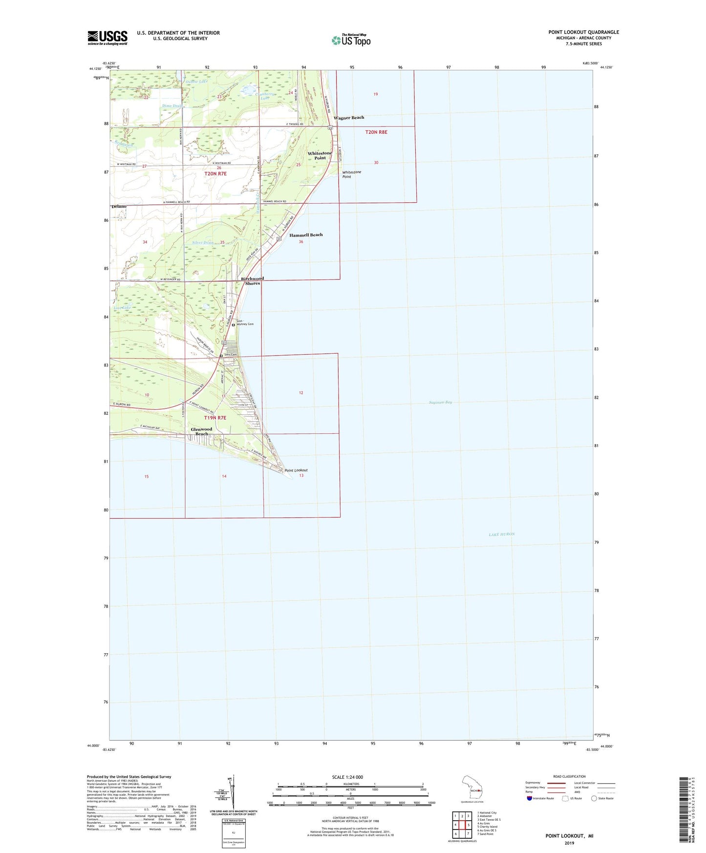
2023 topographic map quadrangle Point Lookout in the state of Michigan. Scale: 1:24000. Based on the newly updated USGS 7.5' US Topo map series, this map is in the following counties: Arenac. The map contains contour data, water features, and other items you are used to seeing on USGS maps, but also has updated roads and other features. This is the next generation of topographic maps. Printed on high-quality waterproof paper with UV fade-resistant inks.
Quads adjacent to this one:
West: Au Gres
Northwest: National City
North: Alabaster
Northeast: East Tawas OE S
East: Charity Island
Southeast: Sand Point
Southwest: Au Gres OE S
This map covers the same area as the classic USGS quad with code o44083a5.
Contains the following named places: Birchwood Shores, Cranberry Lake, Ed Wise Fishery, Glenwood Beach, Gravelly Shoal Light, Hammell Beach, Hammell Creek, Huron Breeze Golf and Country Club, Lost Lake, Oxbow Lake, Point Lookout, Silver Drain, Sims - Whitney Cemetery, Sims Cemetery, Township of Sims, Township of Whitney, Wagner Beach, Whitestone Point