MyTopo
Point Patterson Michigan US Topo Map
Couldn't load pickup availability
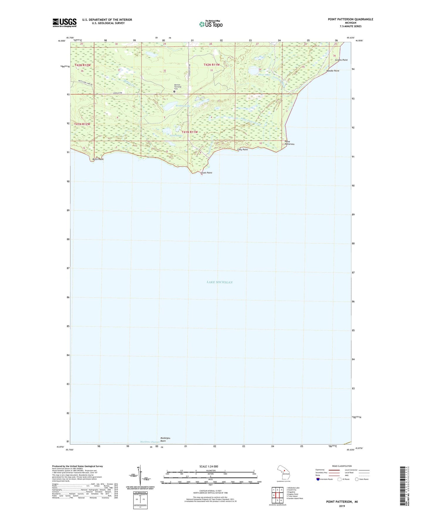
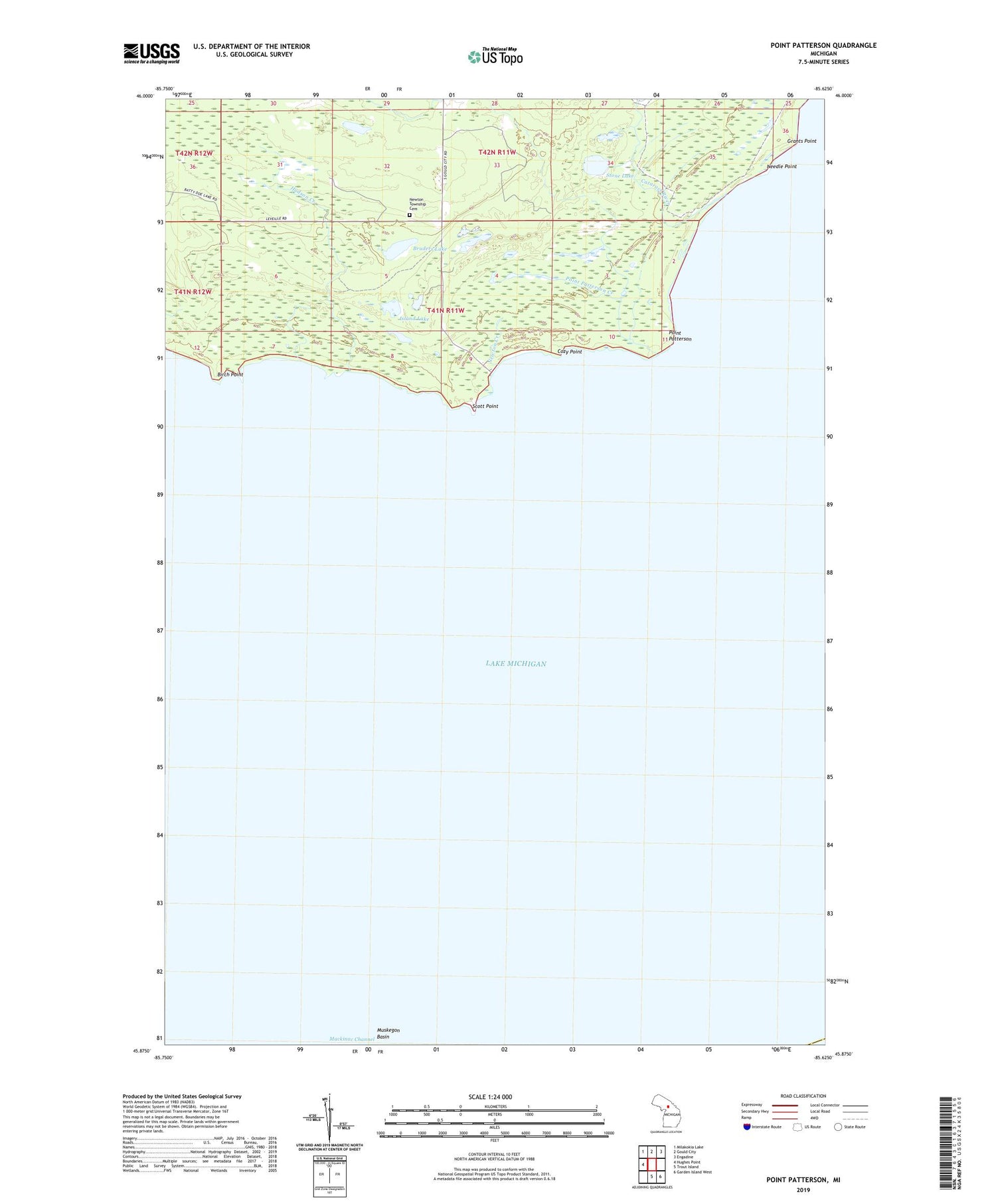
2019 topographic map quadrangle Point Patterson in the state of Michigan. Scale: 1:24000. Based on the newly updated USGS 7.5' US Topo map series, this map is in the following counties: Mackinac, Charlevoix. The map contains contour data, water features, and other items you are used to seeing on USGS maps, but also has updated roads and other features. This is the next generation of topographic maps. Printed on high-quality waterproof paper with UV fade-resistant inks.
Quads adjacent to this one:
West: Hughes Point
Northwest: Milakokia Lake
North: Gould City
Northeast: Engadine
Southeast: Garden Island West
South: Trout Island
Contains the following named places: Birch Point, Bruders Lake, Cataract River, Cozy Point, Gould City Township Park, Grants Point, Hudson Creek, Island Lake, Needle Point, Newton Creek, Newton Township Cemetery, Orville Post Office, Point Patterson, Point Patterson Creek, Scott Point, Stone Lake