MyTopo
Price Michigan US Topo Map
Couldn't load pickup availability
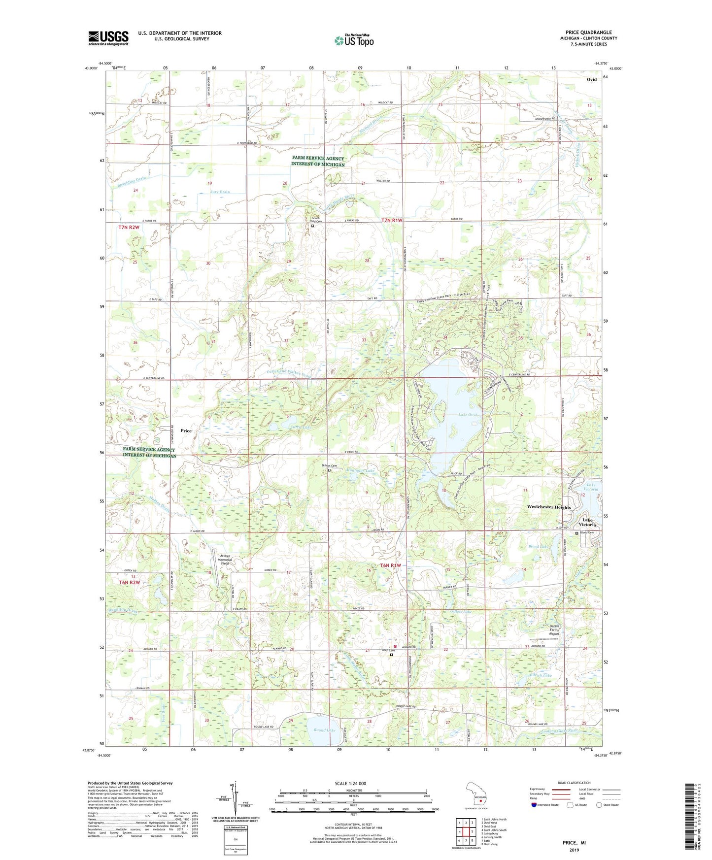
2019 topographic map quadrangle Price in the state of Michigan. Scale: 1:24000. Based on the newly updated USGS 7.5' US Topo map series, this map is in the following counties: Clinton. The map contains contour data, water features, and other items you are used to seeing on USGS maps, but also has updated roads and other features. This is the next generation of topographic maps. Printed on high-quality waterproof paper with UV fade-resistant inks.
Quads adjacent to this one:
West: Saint Johns South
Northwest: Saint Johns North
North: Ovid West
Northeast: Ovid East
East: Laingsburg
Southeast: Shaftsburg
South: Bath
Southwest: Lansing North
Contains the following named places: Aldrich Lake, Archer Memorial Field, Blood Cemetery, Blood Lake, Cedar Lake, Clinton Area Fire and Rescue Station 3, Curtis Lake, Cutler and Walker Drain, Dennis Farms Airport, Geary Post Office, Giffels Lake, Grove Bible Church, Hickok Drain, Holstein Farm, Jessie Post Office, Jury Drain, Kelley Farms, Kniffin Drain, Lake Ovid, Martin Farms, Miller Brothers Farm, Montague Lake, Mud Lake, Pline Farms, Price, Price Post Office, Price United Methodist Church, Reed Cemetery, Richmond Lake, Round Lake, Shepard Drain, Sleepy Hollow State Park, South Ovid Cemetery, Stilson Cemetery, Township of Ovid, Township of Victor, Victor Post Office, Walter Farm, Werner Farm, Westchester Heights, Wyrick Farm, ZIP Code: 48866