MyTopo
Rattle Run Michigan US Topo Map
Couldn't load pickup availability
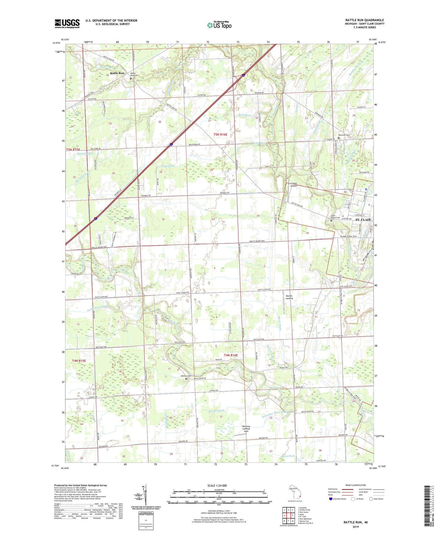
2019 topographic map quadrangle Rattle Run in the state of Michigan. Scale: 1:24000. Based on the newly updated USGS 7.5' US Topo map series, this map is in the following counties: St. Clair. The map contains contour data, water features, and other items you are used to seeing on USGS maps, but also has updated roads and other features. This is the next generation of topographic maps. Printed on high-quality waterproof paper with UV fade-resistant inks.
Quads adjacent to this one:
West: Adair
Northwest: Goodells
North: Smiths Creek
Northeast: Port Huron
Southeast: Marine City OE E
South: Marine City
Southwest: New Baltimore
Contains the following named places: Adair Gas and Oil Field, Angel Creek, Balfour Cemetery, Barringer Drain, Belle River Mills, Belle River Mills Gas Storage Area, Big Hand Drain, Bowman Cemetery, Bowman Drain, Brandywine Creek, Camp Hawthorn, Camp Otsikea, Cooper Drain, Crossroads Community Church, Crystal Airport, David's Landing, East China School, Eschenburg Drain, First Baptist Church, Gearing Elementary School, Harris Drain, Hextell Drain, Hurst Drain, Jehovah's Witnesses, Jordan Creek, Kreusel Drain, Layle Rabbins Drain, Mackley Drain, Milton J Gearing School, Moak Drain, Pauly Drain, Pine River School, Rattle Run, Rattle Run Cemetery, Rattlerun Post Office, Saint Clair High School, Saint Clair Landing Shopping Center, Saint Clair Place Mobile Home Park, Saint Clair Police Department, Saint Marys Cemetery, Salem Church, Schneider China Drain, Sheldon Drain, Township of China, Township of Saint Clair, Wenning Landing Area, Wolf Drain, ZIP Codes: 48054, 48079