MyTopo
Riverdale Michigan US Topo Map
Couldn't load pickup availability
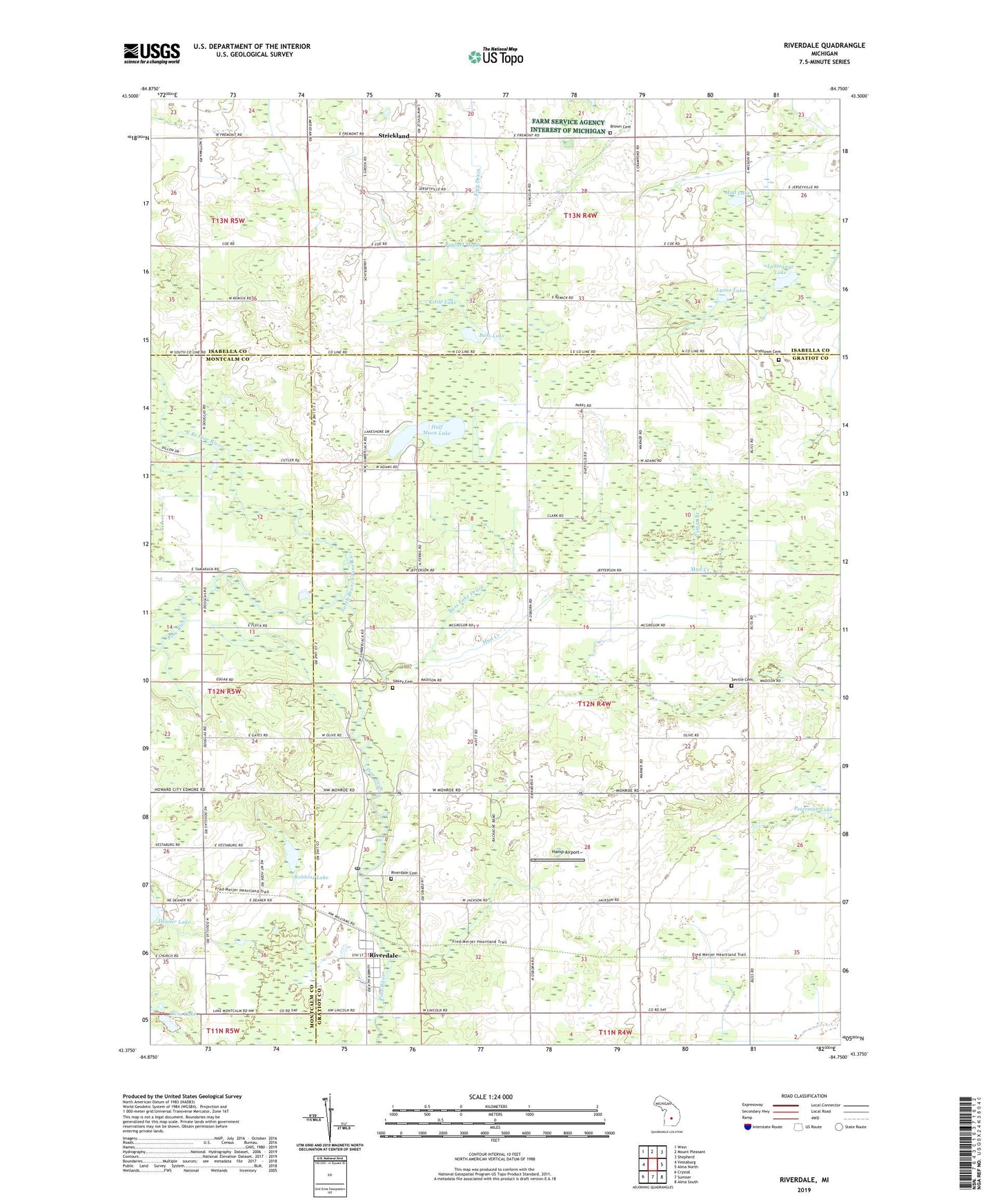
2019 topographic map quadrangle Riverdale in the state of Michigan. Scale: 1:24000. Based on the newly updated USGS 7.5' US Topo map series, this map is in the following counties: Gratiot, Isabella, Montcalm. The map contains contour data, water features, and other items you are used to seeing on USGS maps, but also has updated roads and other features. This is the next generation of topographic maps. Printed on high-quality waterproof paper with UV fade-resistant inks.
Quads adjacent to this one:
West: Vestaburg
Northwest: Winn
North: Mount Pleasant
Northeast: Shepherd
East: Alma North
Southeast: Alma South
South: Sumner
Southwest: Crystal
Contains the following named places: Bass Lake, Bass Lake Drain, Beaver Creek Post Office, Brown Cemetery, Half Moon Lake, Half Moon Lake Campground, Hamp Airport, Irishtown Cemetery, Irishtown Church, Jerseyville Church, Jerseyville Post Office, Kittle Lake, LaStrange Lake, Lighthouse Baptist Church, Lincoln Road United Methodist Church, Lumberjack Park, Lumberjack Park Historical Marker, Lyons Lake, Mud Creek, Mud Lake, North Branch Pine River, Parcher Drain, Peterman Lake, Riverdale, Riverdale Cemetery, Riverdale Census Designated Place, Riverdale Post Office, Riverdale Station, Robbins Lake, Rust and Hay School, Seville Cemetery, Seville Church, Sibley Cemetery, Strickland, Strickland Baptist Church, Strickland Post Office, Tabernacle Church, Timber Country Mobile Home Park, Township of Seville, Twin Lake, Tyman Branch, ZIP Codes: 48832, 48877