MyTopo
Winn Michigan US Topo Map
Couldn't load pickup availability
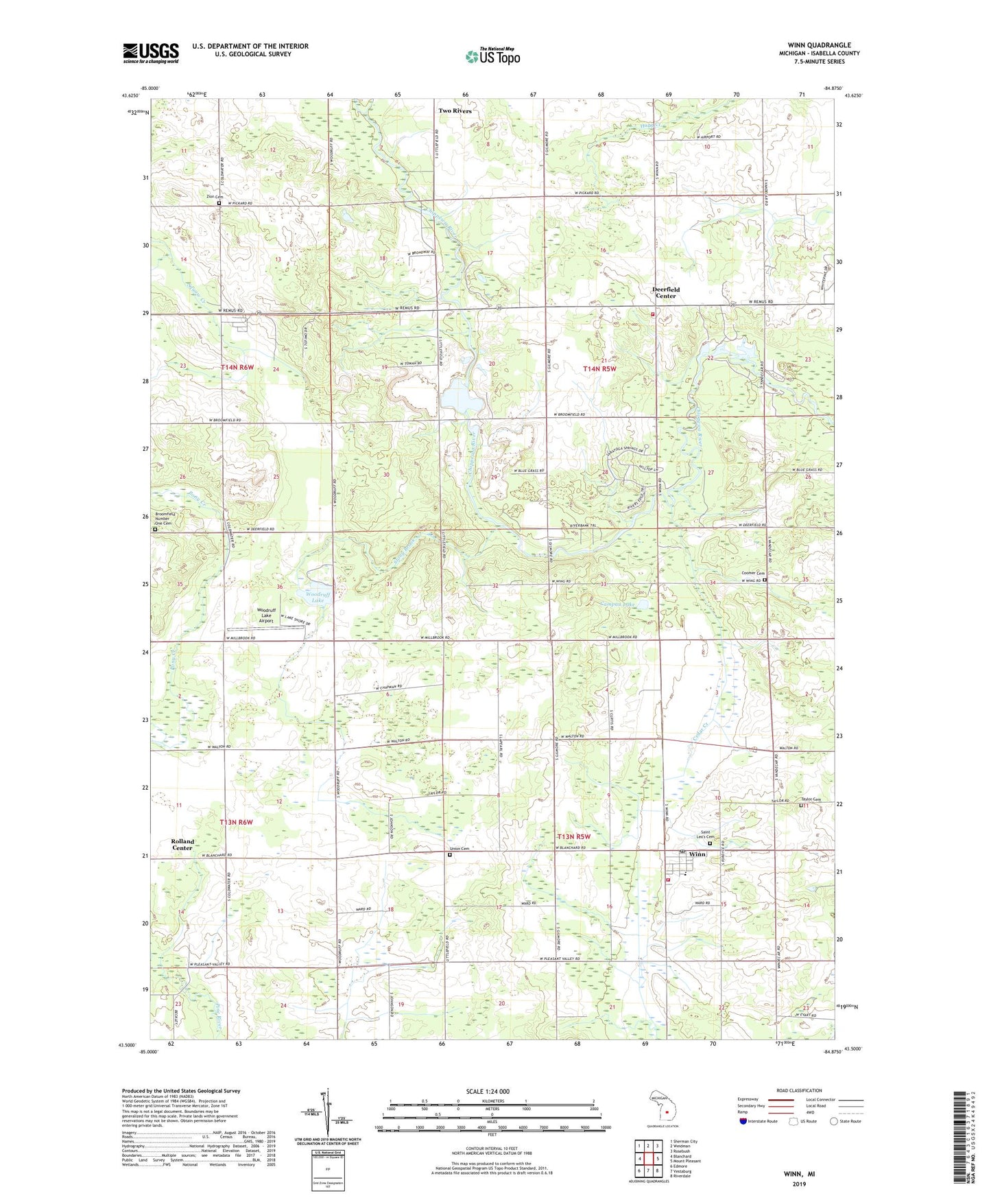
2023 topographic map quadrangle Winn in the state of Michigan. Scale: 1:24000. Based on the newly updated USGS 7.5' US Topo map series, this map is in the following counties: Isabella. The map contains contour data, water features, and other items you are used to seeing on USGS maps, but also has updated roads and other features. This is the next generation of topographic maps. Printed on high-quality waterproof paper with UV fade-resistant inks.
Quads adjacent to this one:
West: Blanchard
Northwest: Sherman City
North: Weidman
Northeast: Rosebush
East: Mount Pleasant
Southeast: Riverdale
South: Vestaburg
Southwest: Edmore
This map covers the same area as the classic USGS quad with code o43084e8.
Contains the following named places: Barnard Lake, Boyden Post Office, Broomfield Number One Cemetery, Broomfield Valley Mobile Home Park, Campau Lake, Cedar Creek, Christ Community Fellowship Church, Coldwater River, Coomer Cemetery, Coomer Church, Coomer Post Office, Deerfield Center, Deerfield Nature Park, Deerfield Township Fire Department, Fremont Township Fire Department, Fremont Township First Response Fire Department, Indian Mound Park, Long Pond, Majeske Landing County Park, Memorial Park, Rigglees Lake, Rolland Center, Rowland Post Office, Saint Leo's Cemetery, Saint Leos Church, Stony Brook, Taylor Cemetery, Township of Deerfield, Township of Fremont, Trinity Church, Union Cemetery, Winn, Winn Census Designated Place, Winn Community Building, Winn Elementary School, Winn Post Office, Woodruff Lake, Woodruff Lake Airport, Zion Cemetery, Zion Church, ZIP Code: 48896