MyTopo
Alma South Michigan US Topo Map
Couldn't load pickup availability
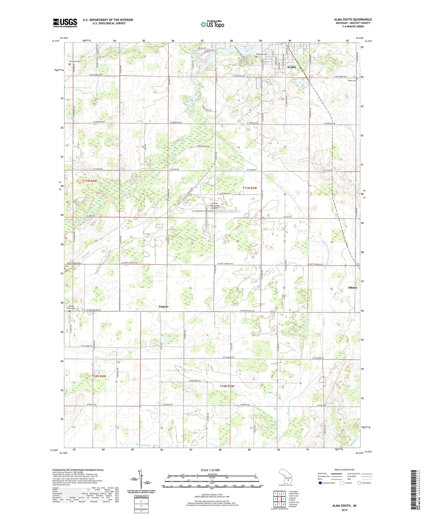
2023 topographic map quadrangle Alma South in the state of Michigan. Scale: 1:24000. Based on the newly updated USGS 7.5' US Topo map series, this map is in the following counties: Gratiot. The map contains contour data, water features, and other items you are used to seeing on USGS maps, but also has updated roads and other features. This is the next generation of topographic maps. Printed on high-quality waterproof paper with UV fade-resistant inks.
Quads adjacent to this one:
West: Sumner
Northwest: Riverdale
North: Alma North
Northeast: Saint Louis
East: Ithaca
Southeast: Pompeii
South: Perrinton
Southwest: Carson City
This map covers the same area as the classic USGS quad with code o43084c6.
Contains the following named places: Alma Church of the Nazarene, Bailey Cemetery, Bailey School, Ely Church, Eugene, Eugene Post Office, Gratiot Community Airport, Hillcrest School, Honeyoey Creek, Meadows Mobile Home Park, Morse School, Newark and Arcadia Drain, Newark Church, Pine River Park, Pritchard Cemetery, Riverside Cemetery, Riverside Park, Roosa Farm Cemetery, Sumner Oil Field, Township of Arcada, ZIP Code: 48801