MyTopo
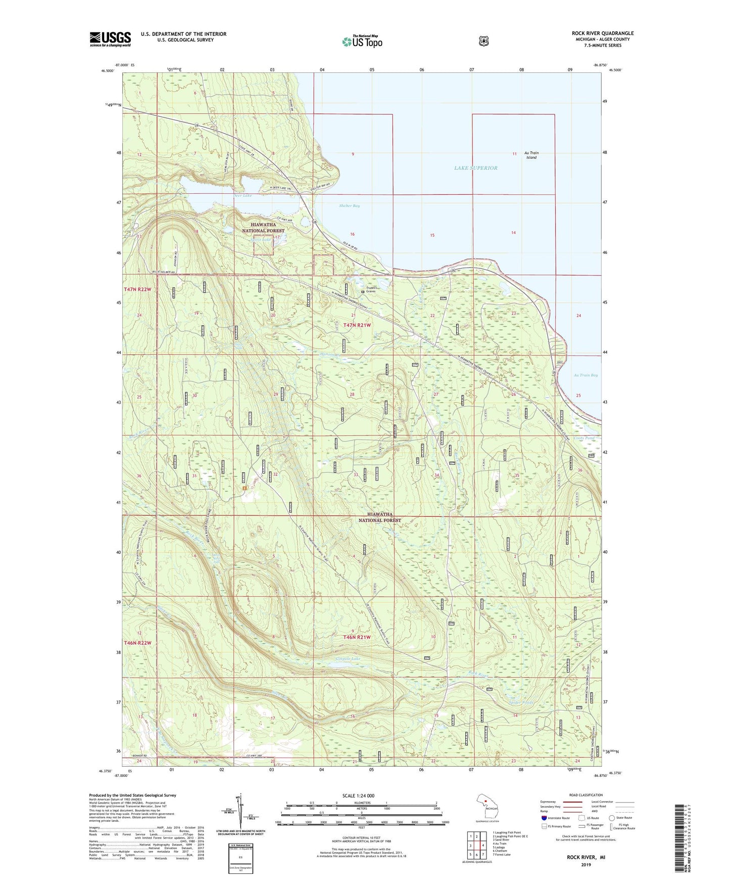
Rock River Michigan US Topo Map
Couldn't load pickup availability
Also explore the Rock River Forest Service Topo of this same quad for updated USFS data
2023 topographic map quadrangle Rock River in the state of Michigan. Scale: 1:24000. Based on the newly updated USGS 7.5' US Topo map series, this map is in the following counties: Alger. The map contains contour data, water features, and other items you are used to seeing on USGS maps, but also has updated roads and other features. This is the next generation of topographic maps. Printed on high-quality waterproof paper with UV fade-resistant inks.
Quads adjacent to this one:
West: Sand River
Northwest: Laughing Fish Point
North: Laughing Fish Point OE E
East: Au Train
Southeast: Forest Lake
South: Chatham
Southwest: Ladoga
This map covers the same area as the classic USGS quad with code o46086d8.
Contains the following named places: Au Train Bay, Au Train Island, B A Creek, CCC Camp, Deer Lake, Deer Lake Roadside Park, Ginpole Lake, Hanson Creek, Johnson Lake Lookout Tower, Onota, Onota Post Office, Onota Station, Rock River, Rock River Canyon Wilderness, Rock River Falls, Rock River Post Office, Rock River Station, Shelter Bay, Silver Creek, Silver Falls, Spider Ponds, Spirit Lake, Township of Onota, Trudell's Graves, ZIP Code: 49806