MyTopo
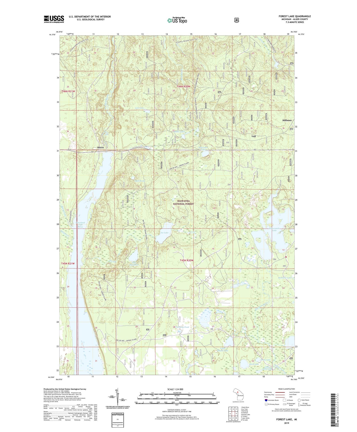
Forest Lake Michigan US Topo Map
Couldn't load pickup availability
Also explore the Forest Lake Forest Service Topo of this same quad for updated USFS data
2023 topographic map quadrangle Forest Lake in the state of Michigan. Scale: 1:24000. Based on the newly updated USGS 7.5' US Topo map series, this map is in the following counties: Alger. The map contains contour data, water features, and other items you are used to seeing on USGS maps, but also has updated roads and other features. This is the next generation of topographic maps. Printed on high-quality waterproof paper with UV fade-resistant inks.
Quads adjacent to this one:
West: Chatham
Northwest: Rock River
North: Au Train
Northeast: Munising
East: Powell Lake
Southeast: Tie Lake
South: Lake Stella
Southwest: Trenary
This map covers the same area as the classic USGS quad with code o46086c7.
Contains the following named places: Ackerman Lake, Addis Lakes, Addis Lakes Ski Trail, Aleck Lake, Au Train Falls, AuTrain Township Fire Department, Bunting Lake, CCC Camp, Cleveland Cliffs Basin, Dixon, Forest Lake, Forest Lake Campground and Picnic Area, Forest Lake Lookout Tower, Forest Lake Post Office, Forest Lake Station, Grassy Pond, Jenny Lake, Joe Creek, Joe Lake, Lake Seventeen, Line Lake, Little Aleck Lake, Little Round Lake, Odell Pond, Sixteenmile Lake, Slapneck Creek, Stillman, Township of Au Train, Vail, Wheelbarrow Lake