MyTopo
Rockhouse Point Michigan US Topo Map
Couldn't load pickup availability
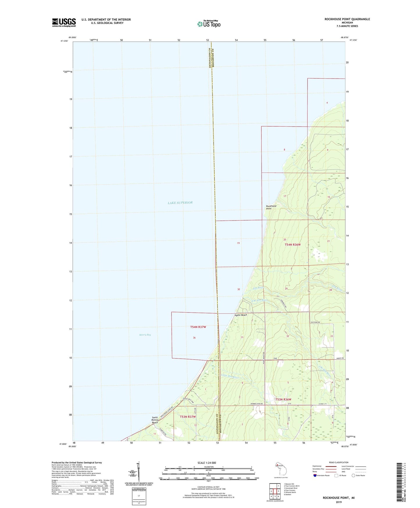
2023 topographic map quadrangle Rockhouse Point in the state of Michigan. Scale: 1:24000. Based on the newly updated USGS 7.5' US Topo map series, this map is in the following counties: Houghton, Ontonagon. The map contains contour data, water features, and other items you are used to seeing on USGS maps, but also has updated roads and other features. This is the next generation of topographic maps. Printed on high-quality waterproof paper with UV fade-resistant inks.
Quads adjacent to this one:
West: Four Corners OE N
Northeast: Beacon Hill
East: Graveraet River
Southeast: Donken
South: Winona North
Southwest: Four Corners
This map covers the same area as the classic USGS quad with code o47088a8.
Contains the following named places: Agate Beach, Elm River, Little Elm River, Misery Bay, Rockhouse Point, Santa Monica Beach, South Branch Elm River, Stanton Park