MyTopo
Four Corners Michigan US Topo Map
Couldn't load pickup availability
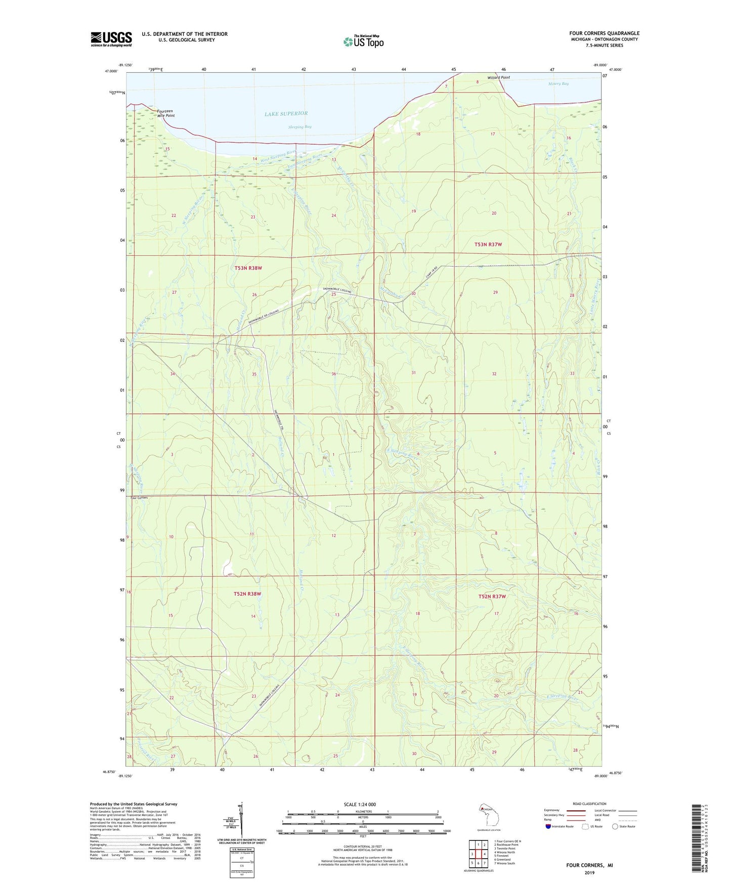
2023 topographic map quadrangle Four Corners in the state of Michigan. Scale: 1:24000. Based on the newly updated USGS 7.5' US Topo map series, this map is in the following counties: Ontonagon. The map contains contour data, water features, and other items you are used to seeing on USGS maps, but also has updated roads and other features. This is the next generation of topographic maps. Printed on high-quality waterproof paper with UV fade-resistant inks.
Quads adjacent to this one:
West: Tenmile Point
North: Four Corners OE N
Northeast: Rockhouse Point
East: Winona North
Southeast: Winona South
South: Greenland
Southwest: Firesteel
This map covers the same area as the classic USGS quad with code o46089h1.
Contains the following named places: Black Creek, Camp 12, Camp 13, Camp 14, Camp 16, Camp 17, Camp 18, Camp 8, Camp 9, East Sleeping River, Four Corners, Fourteen Mile Point, Hilger Camp, Holland Creek, McCarthy Creek, Old Hilger Camp, Ontonagon Reservation, Penegors Camp, Sleeping Bay, West Sleeping River