MyTopo
Rome Center Michigan US Topo Map
Couldn't load pickup availability
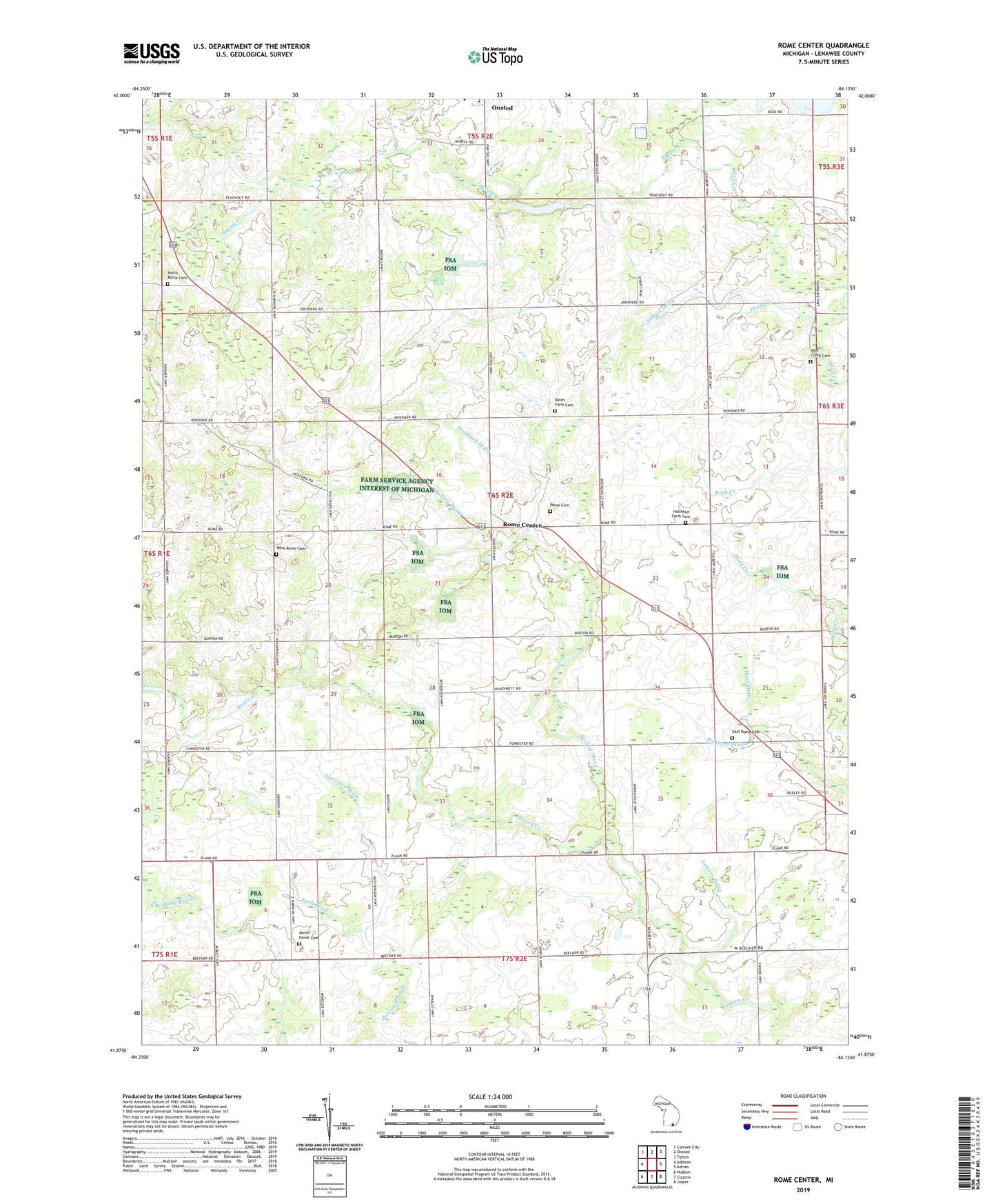
2023 topographic map quadrangle Rome Center in the state of Michigan. Scale: 1:24000. Based on the newly updated USGS 7.5' US Topo map series, this map is in the following counties: Lenawee. The map contains contour data, water features, and other items you are used to seeing on USGS maps, but also has updated roads and other features. This is the next generation of topographic maps. Printed on high-quality waterproof paper with UV fade-resistant inks.
Quads adjacent to this one:
West: Addison
Northwest: Cement City
North: Onsted
Northeast: Tipton
East: Adrian
Southeast: Jasper
South: Clayton
Southwest: Hudson
This map covers the same area as the classic USGS quad with code o41084h2.
Contains the following named places: Atwood Drain, Bates Farm Cemetery, Cole Drain, Dover Post Office, East Rome Cemetery, Four Towns Grange Hall, Fouty Creek, Gilbert Drain, Halstead Farm Cemetery, Hunt Creek, Loars Field Airport, Lowery Drain, Nash Drain, North Dover Cemetery, North Rome Cemetery, North Rome Church, Penrod Drain, Pickford Drain, Rollin Center United Methodist Church, Rome Cemetery, Rome Center, Rome Grange Hall, Rome Post Office, Rome Township Hall, Schnieral Drain, School Number 2, Shepherd School, Squaw Creek, Stoddard Drain, Stoddard Post Office, Township of Rome, Wallace Drain, West Rome Cemetery, West Rome Church, Wolf Creek Cemetery, Wolfcreek Post Office